We aspire to provide comprehensive coverage of Hawaiʻi. In addition to contemporary maps, we have a large collection of historical maps. Nevertheless, it is impossible for one organization to have all the maps, therefore, it is customary to rely on many agencies and collections in Hawaiʻi and beyond. If you do not find what you need in our digital and map collections, consult the links we provide to other collections. If you have questions about our holdings, please contact MAGIS staff.


The maps below are some of the most frequently requested historical maps of the principal islands of Hawaiʻi. Click on the View column to view or download a map. Click on the Preview column to interact with a georeferenced version of a map. Georeferenced TIFF versions of most of the maps are available to download by clicking on the Zipped TIFF file. To view basic metadata for these georeferenced maps, download the companion spreadsheet.
 The State Land Survey Office is the legacy institution of surveys and mapping of Hawaiʻi. The primary mission of the office is to prepare, furnish and maintain maps and descriptions of all public lands required by other State agencies for the issuance of Governor’s Executive Orders, general leases, grants of easements as well as the sale of government lands or purchase of private lands for public purposes. The Office serves as the official depository of thousands of Government Survey Registered Maps and other historic maps, field books, calculations and other survey information.
Unless otherwise indicated by "via ...", maps are from the UH Library Map Collection's digital repository. Includes city and town maps, road maps, and other large-scale maps. Also check out named quadrangles, such as "Honolulu," from topographic sets throughout the decades and fire insurance maps of various areas. Note, images of maps from other libraries have their own use and download policies.
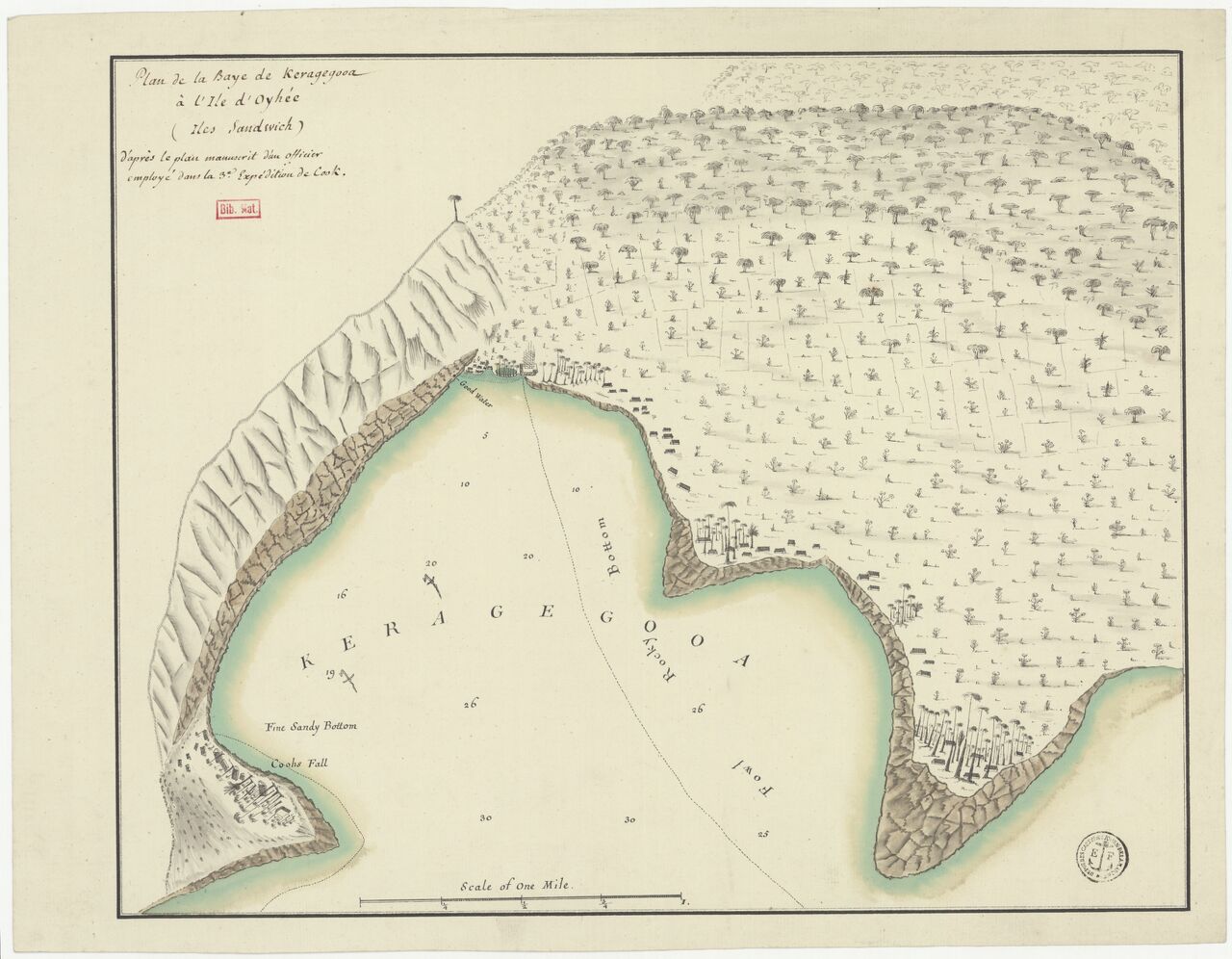 1756 Plan de la Baye de Keragegooa à l'Ile d'Oyhée (Iles Sandwich)
 1812 Kealakekua Bay (inset), The Sandwich Islands (in Russian)
 1841 Harbour of Waiakea, Hilo (Wilkes)
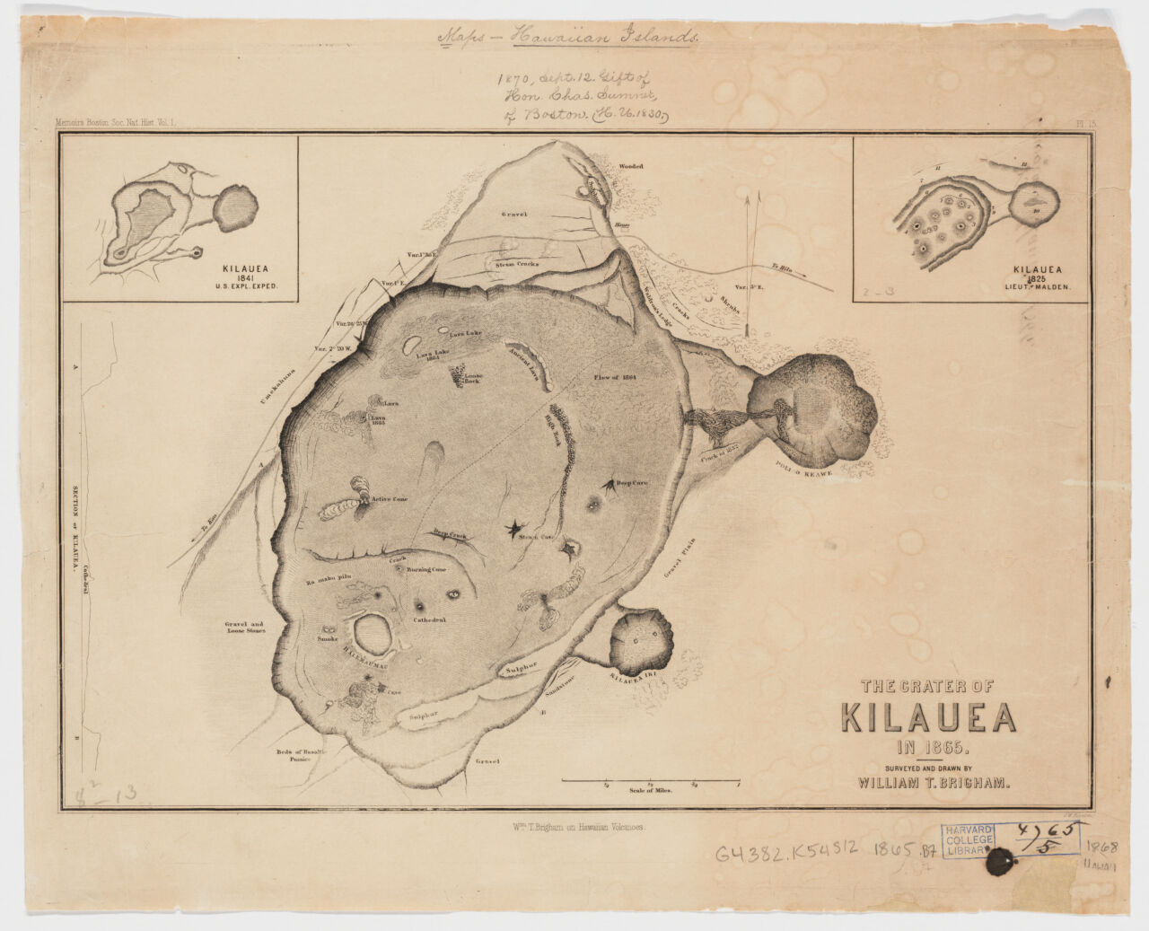 1868 The Crater of Kilauea (Brigham)
 1888 The crater of Kilauea: Hawaii
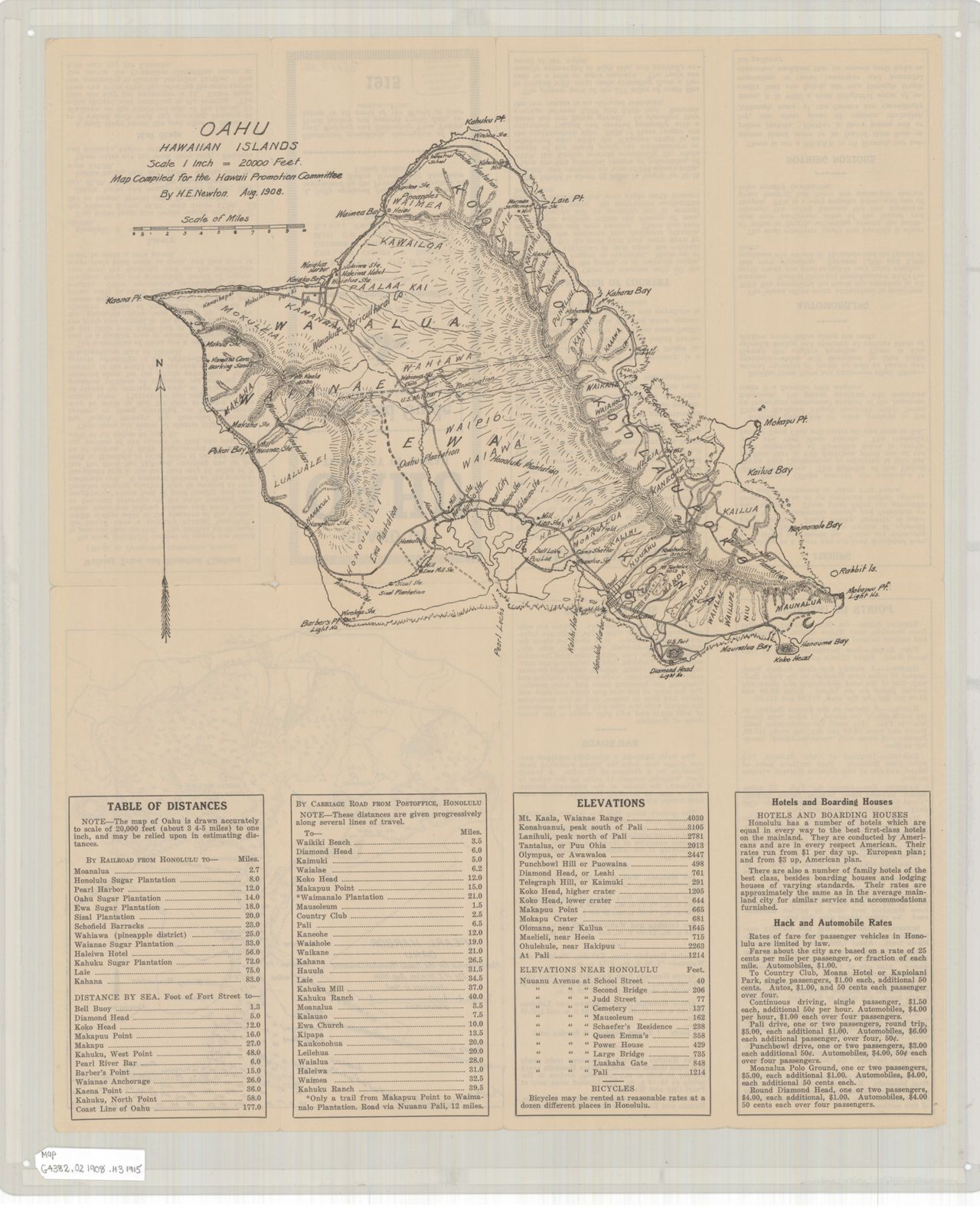
 1917 City of Hilo (Hawaii Promotion Committee)
 1930 Street Map of Hilo
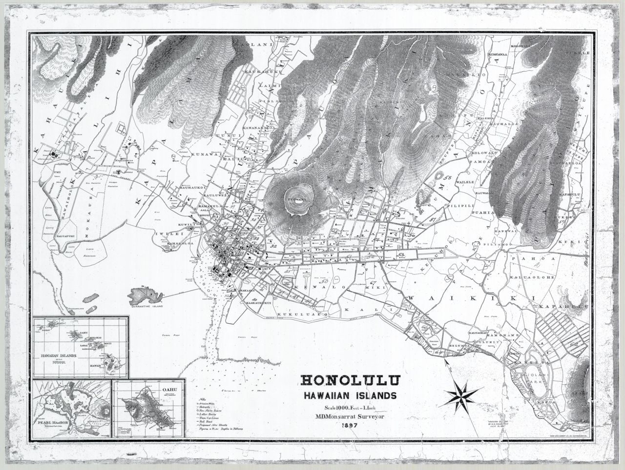
 1826 Honolulu (inset), Map of the Sandwich Islands (in Russian)
 1881 Honolulu Harbor
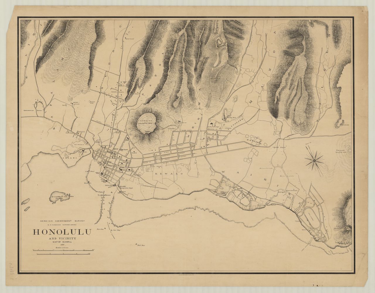
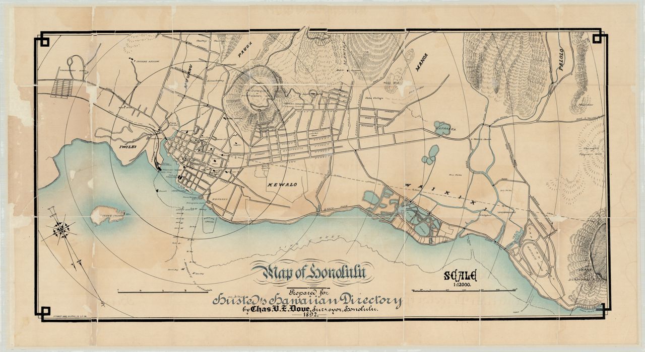
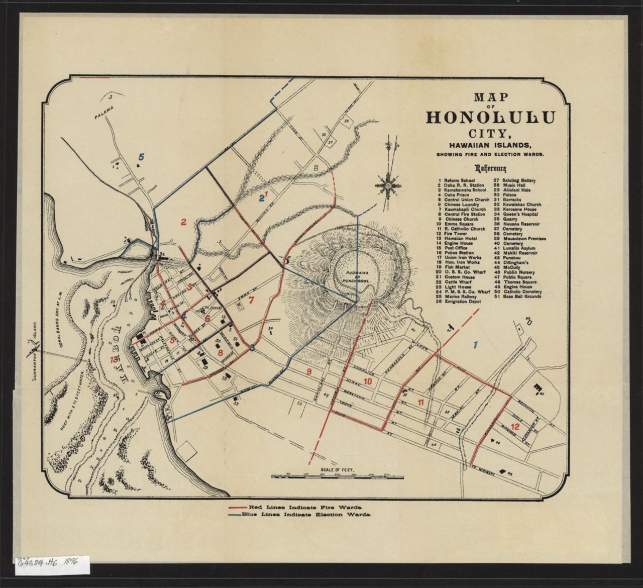
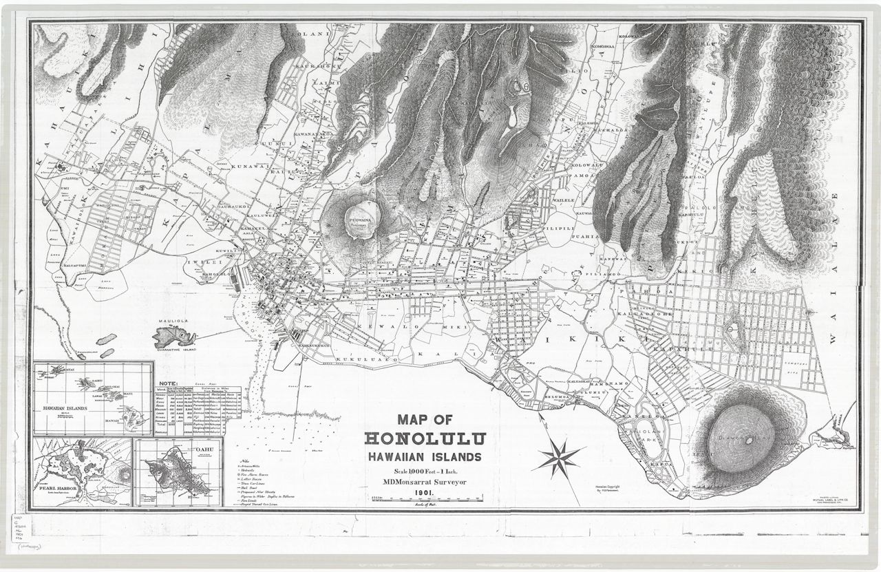
 1893 Map of the lower part of the city of Honolulu and the harbor front (Loebenstein)
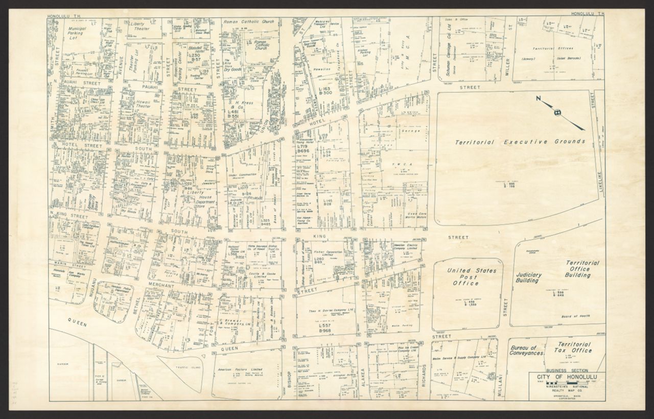
 1906 Honoruru fu yō zu / ホノル 府要圖 / Map of Honolulu
 1907 Honolulu Harbor
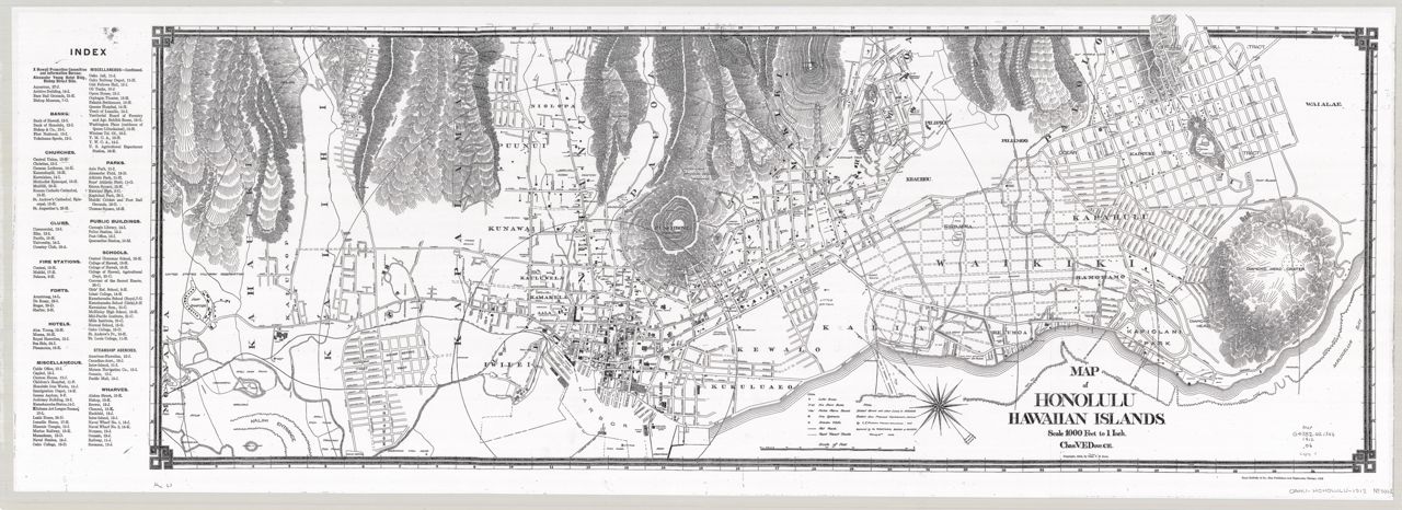
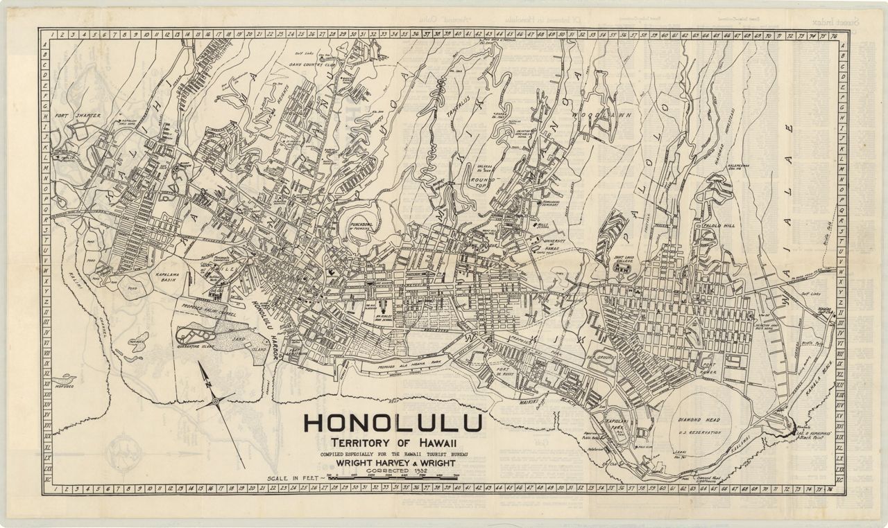
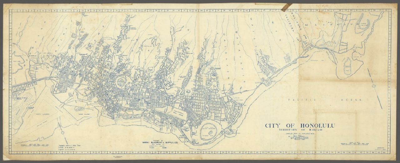
 1915 City of Honolulu (Southworth)
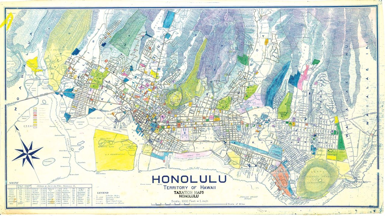
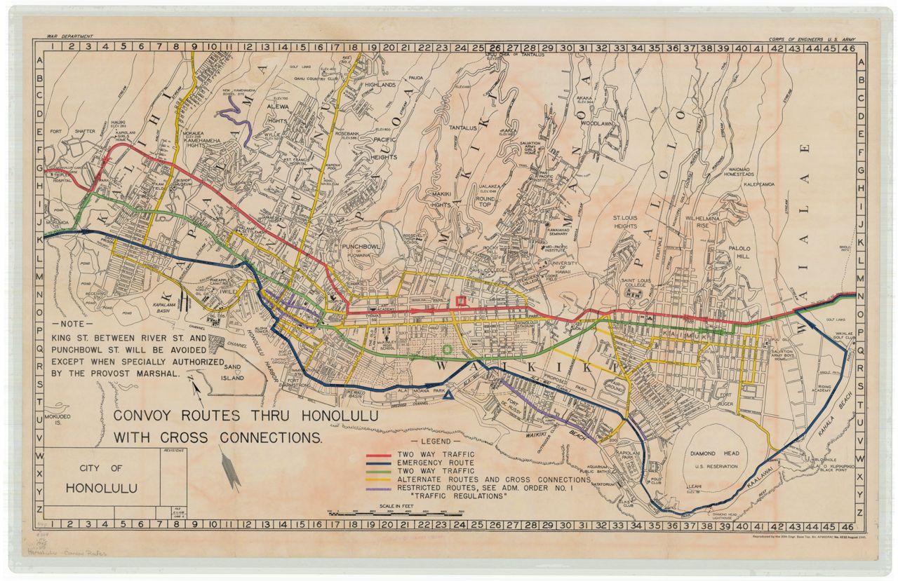
 1956 Shell Street Map of Honolulu
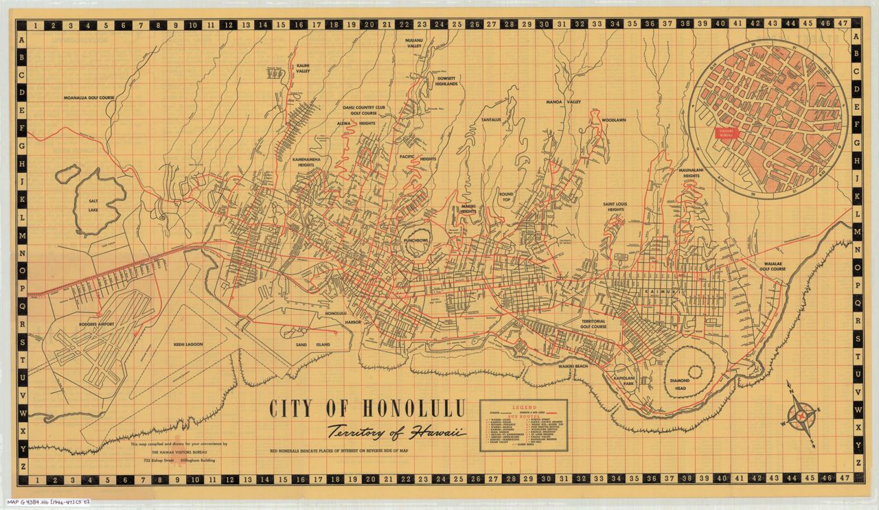
 1959 Street Map of Honolulu (Gousha)
 1873 Mouth and bar of Pearl River (Sands)
 1873 Mouth and bar of Pearl River with pen and ink tracing (Sands)
 1873 Pearl Lochs and Puuloa Entrance (Lyons)
 1873 Preliminary sketch showing the coast line of the Pearl Lochs (Lyons)
 1880 Pearl Lochs
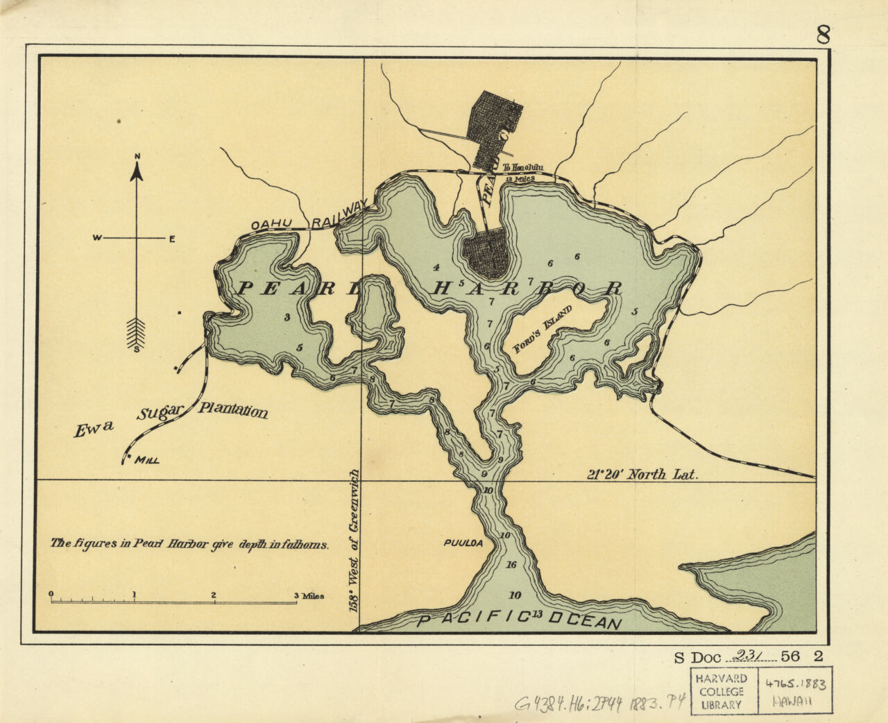 1883 Pearl Harbor, Oahu, Hawaiian Islands
 1901 Pearl Harbor (Newton)
 1907 Pearl Harbor
 1941 Pearl Harbor attack estimated ship damage report (Fuchida)
 1840 "World Map" (Lahainaluna)
Unless otherwise indicated with "via ...", maps are in the UH Library Map Collection's digital repository. Includes whole island maps. Note, images of maps from other libraries have their own use and download policies.
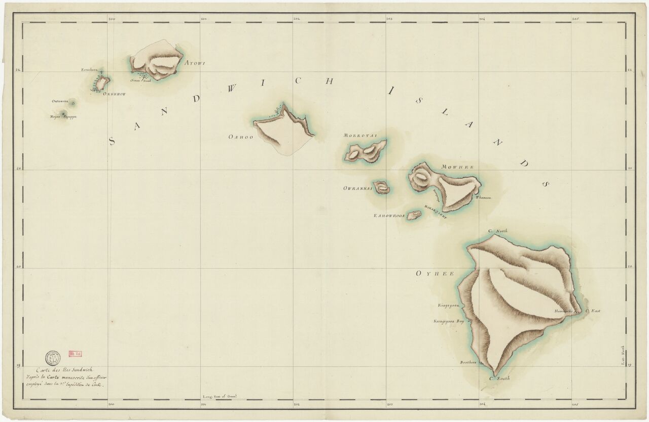 17?? Carte des îles Sandwich d'après la carte manuscrite d'un officier employé dans la 3e expédition de Cook
 1779 Chart of the Sandwich Isles
 1785 Sandwich Islands. Bligh, Cook, Roberts
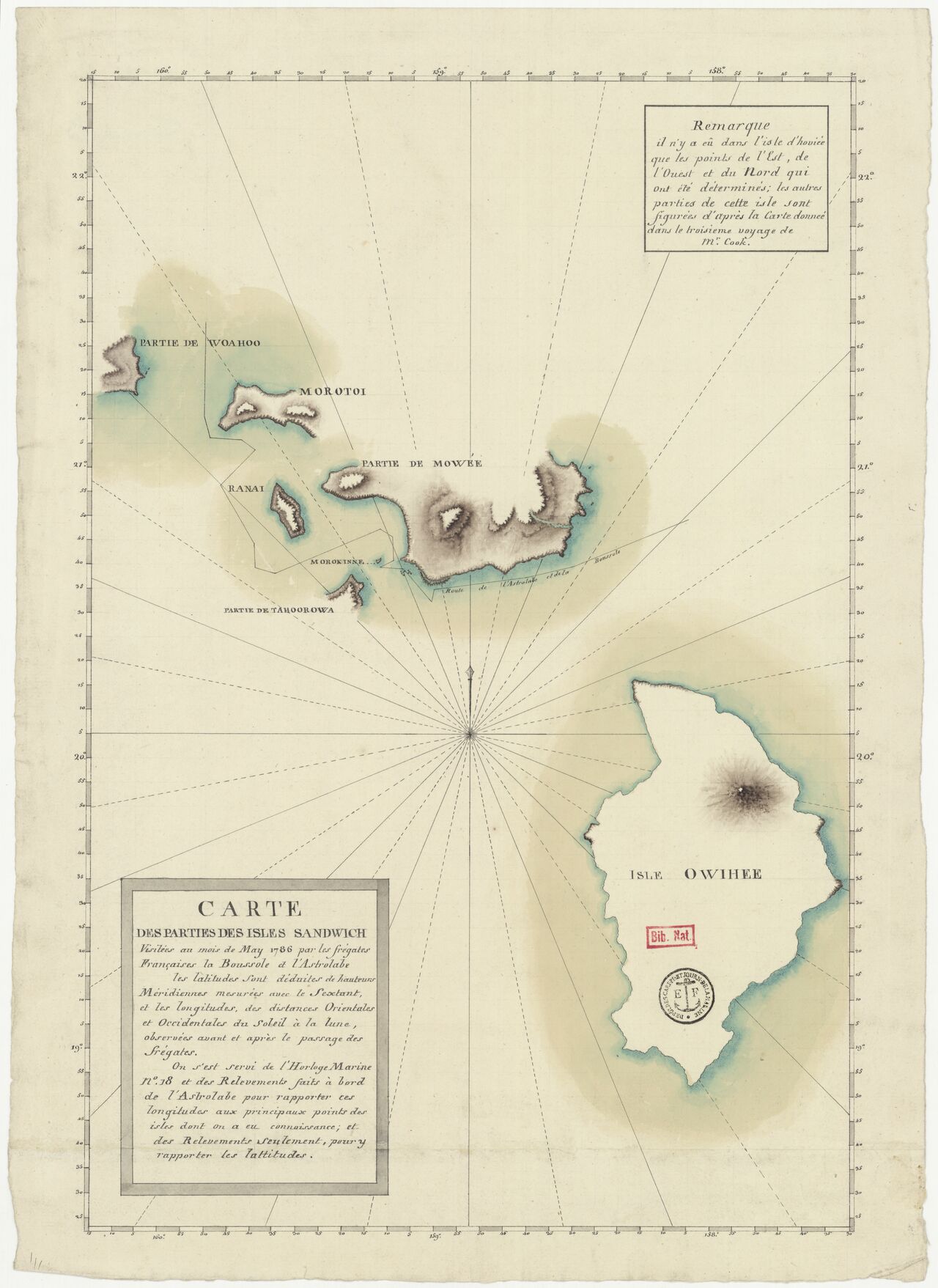 1786 Carte des parties des isles sandwich visitées au mois de May 1786 par les frégates françaises la Bousssole et l'Astrolabe
 1798 Chart of the Sandwich Islands (Vancouver)1812 Sandwich Islands (in Russian)
 1834 Carte des Iles Hawaii (D'Urville)
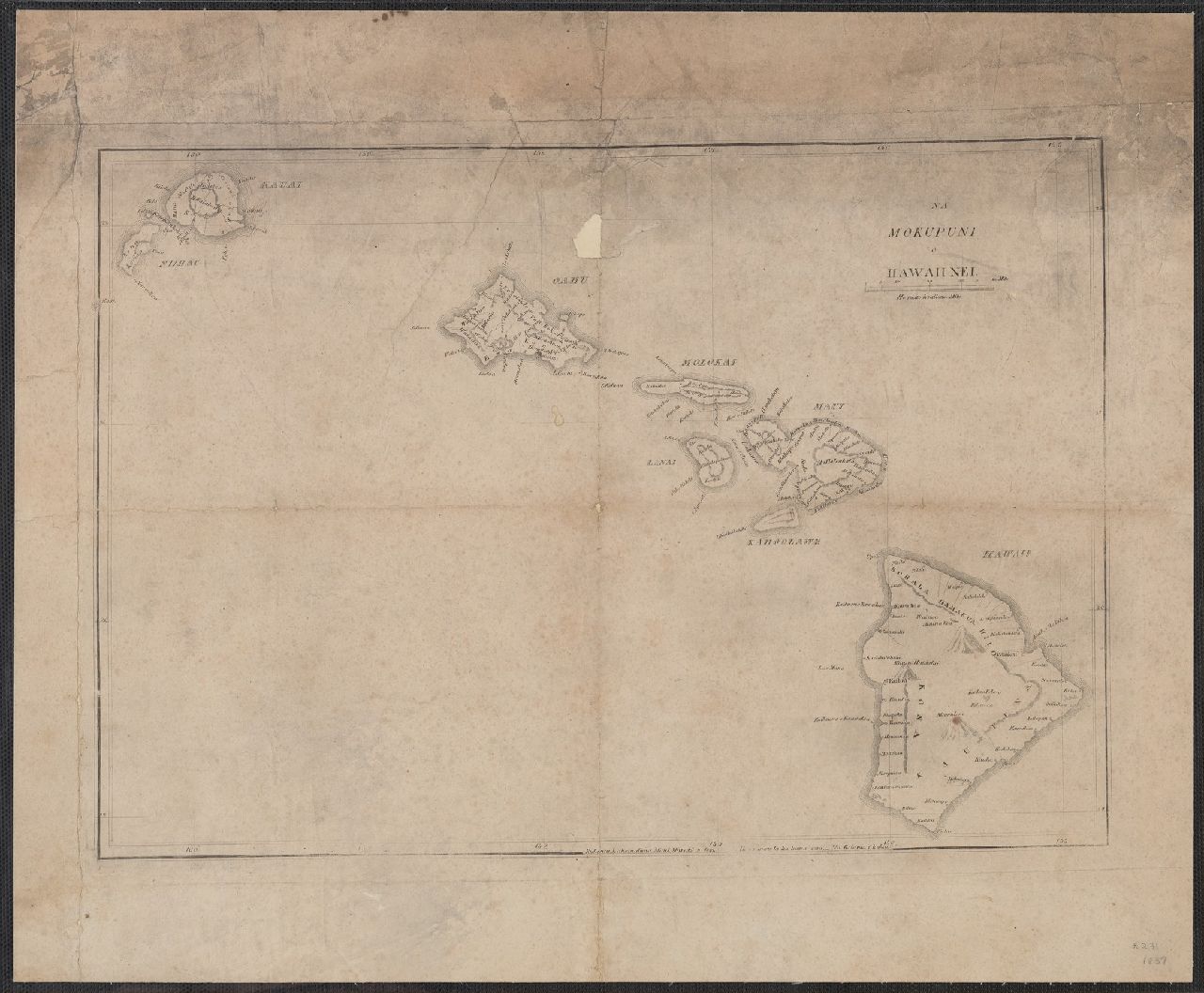 1837 Na Mokupuni o Hawaii Nei. (The Hawaiian Islands) Na Kalama i kakau (drawn by Kalama)
 1837 Na mokupuni o Hawaii nei
 1838 A map of the Hawaiian Islands (1 of 4 parts)
 1846 Missionary map of the Hawaiian or Sandwich Islands
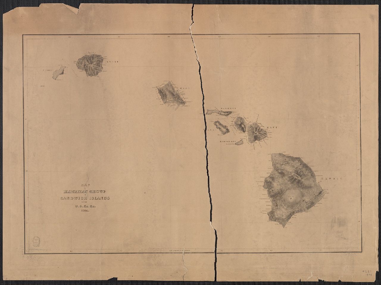
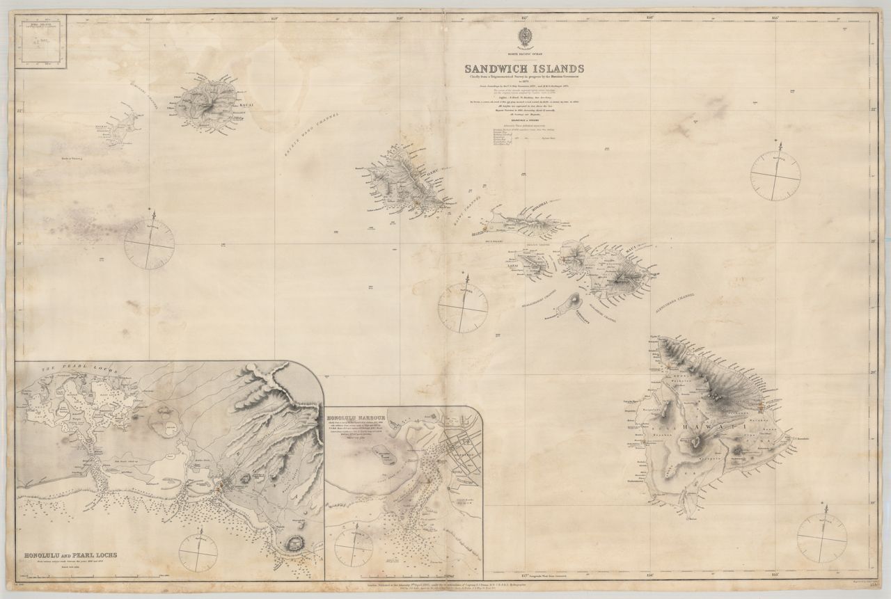
 1876 Map of the Hawaiian Islands
 1893 Topographical map of the Hawaiian Islands
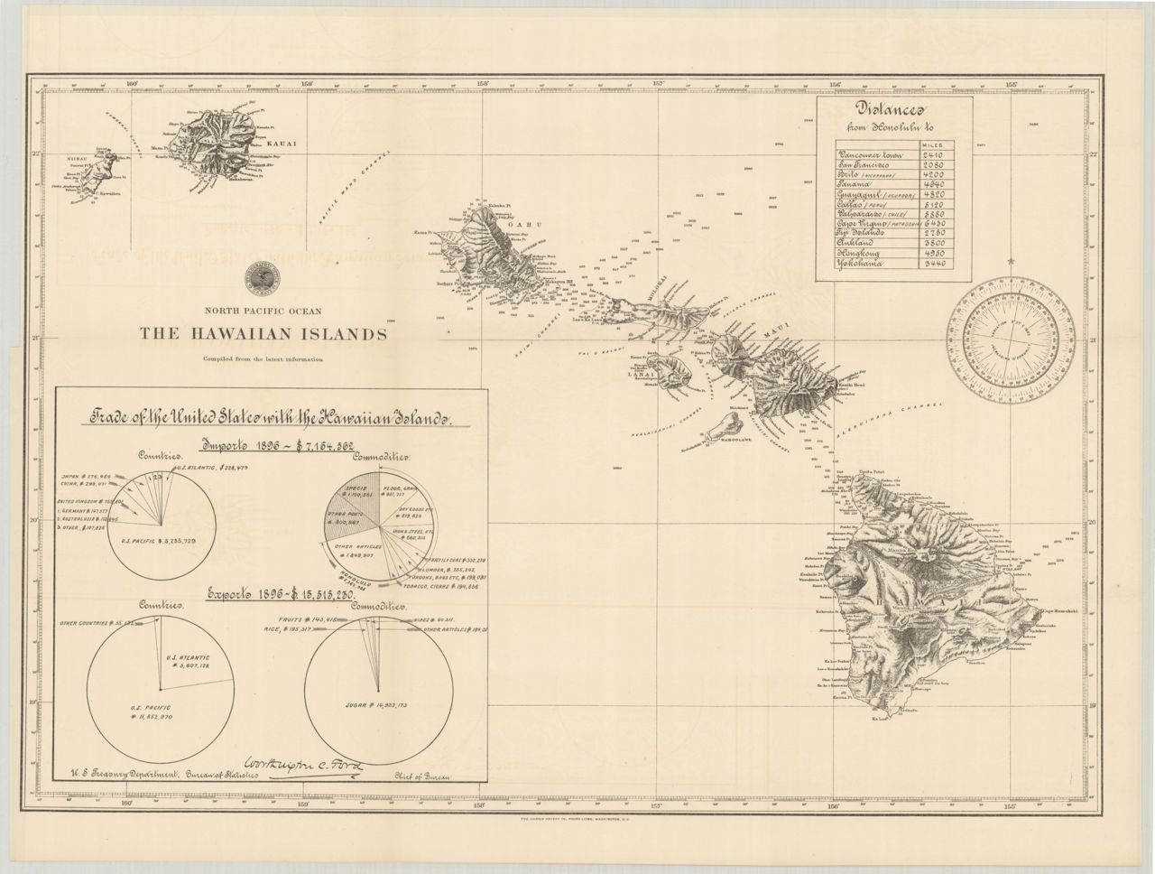
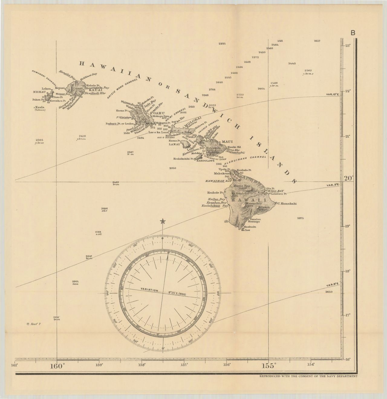
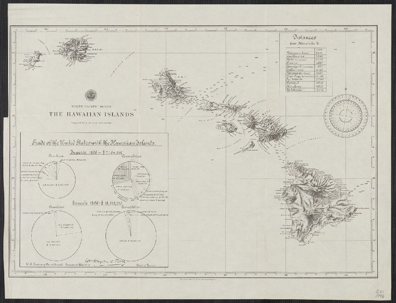 1896 The Hawaiian Islands
 1897 The Hawaiian Islands
 1901 Map of the Territory of Hawaii
 1901 Post Route Map of The Hawaiian Islands
 1906 Newly compiled map of Hawaii (Japanese tourist map)
 1909 The Hawaiian Islands
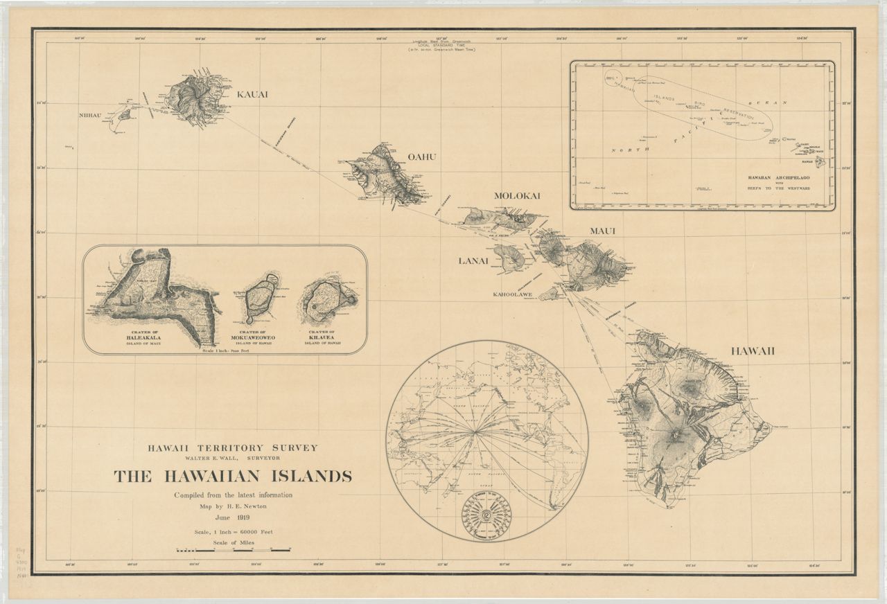
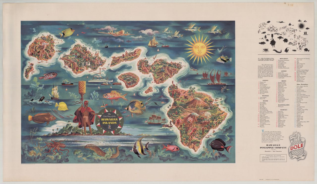
 1937 Dole Map of the Hawaiian Islands U.S.A. Edwards
 1940-1949 Hawaiian Islands (in Japanese)
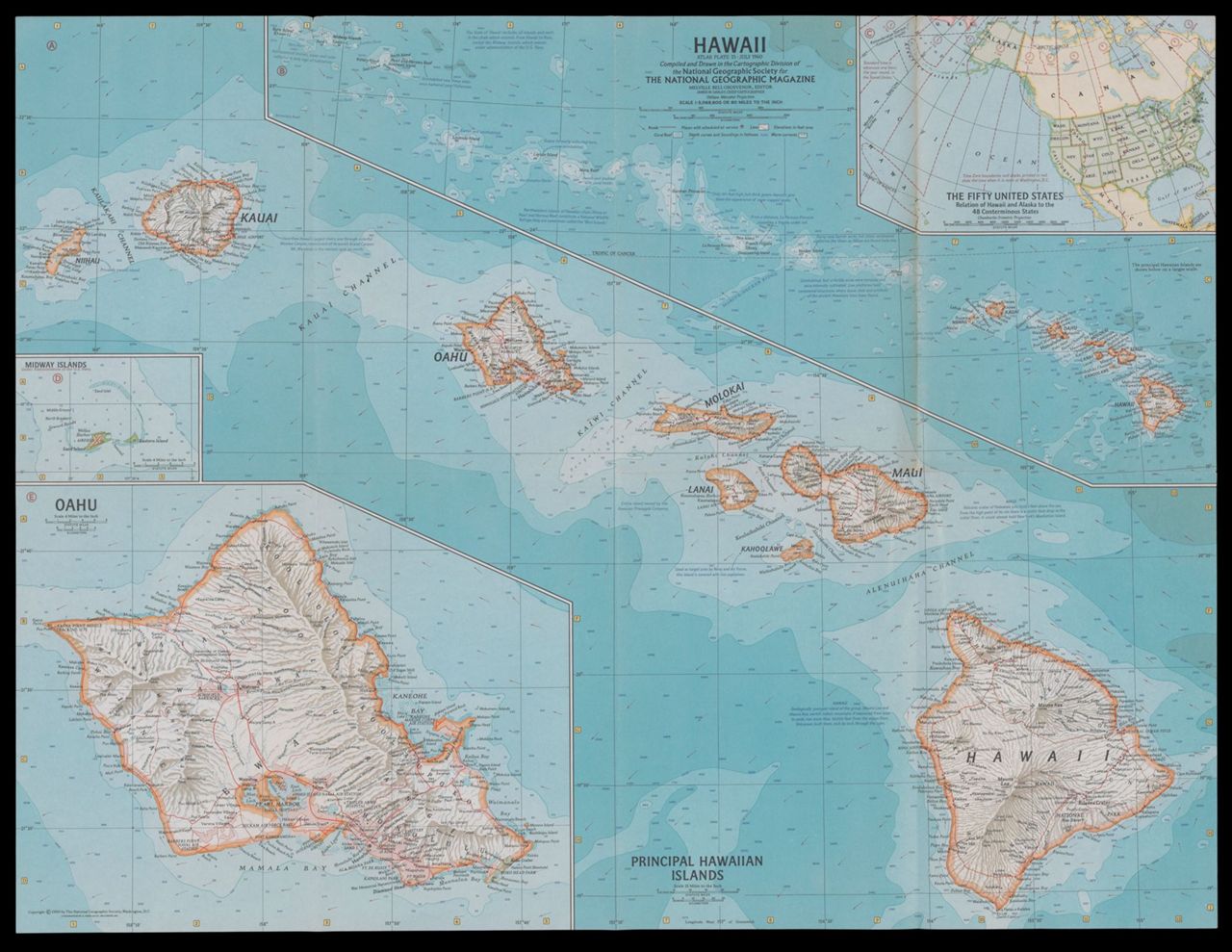 1960 Hawaii : atlas plate 15
 1981 The Islands of Hawaii (pictorial)
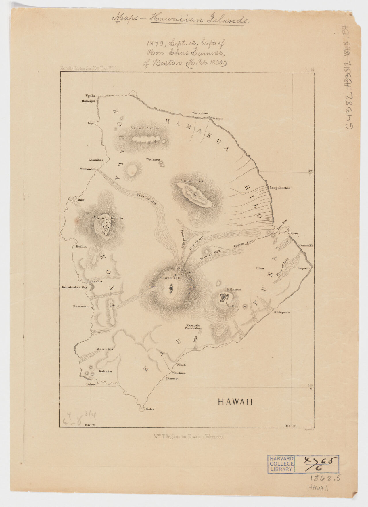 1868 Hawaii, Wm. T. Brigham on Hawaiian volcanoes
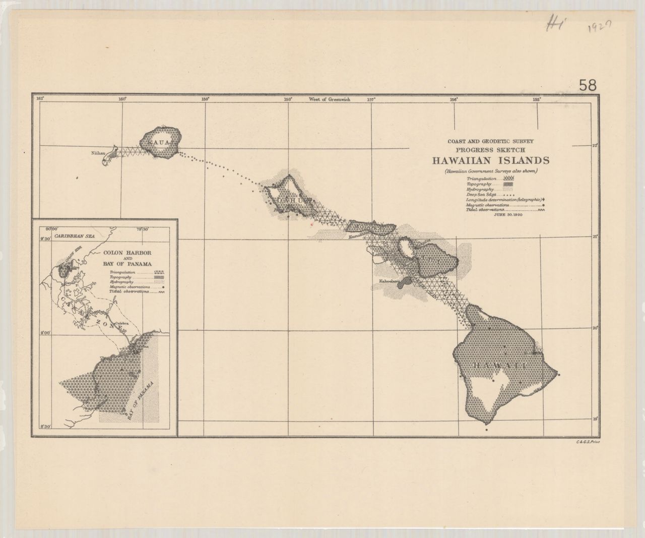
 1911 Hawaii (Coast and Geodetic Survey)
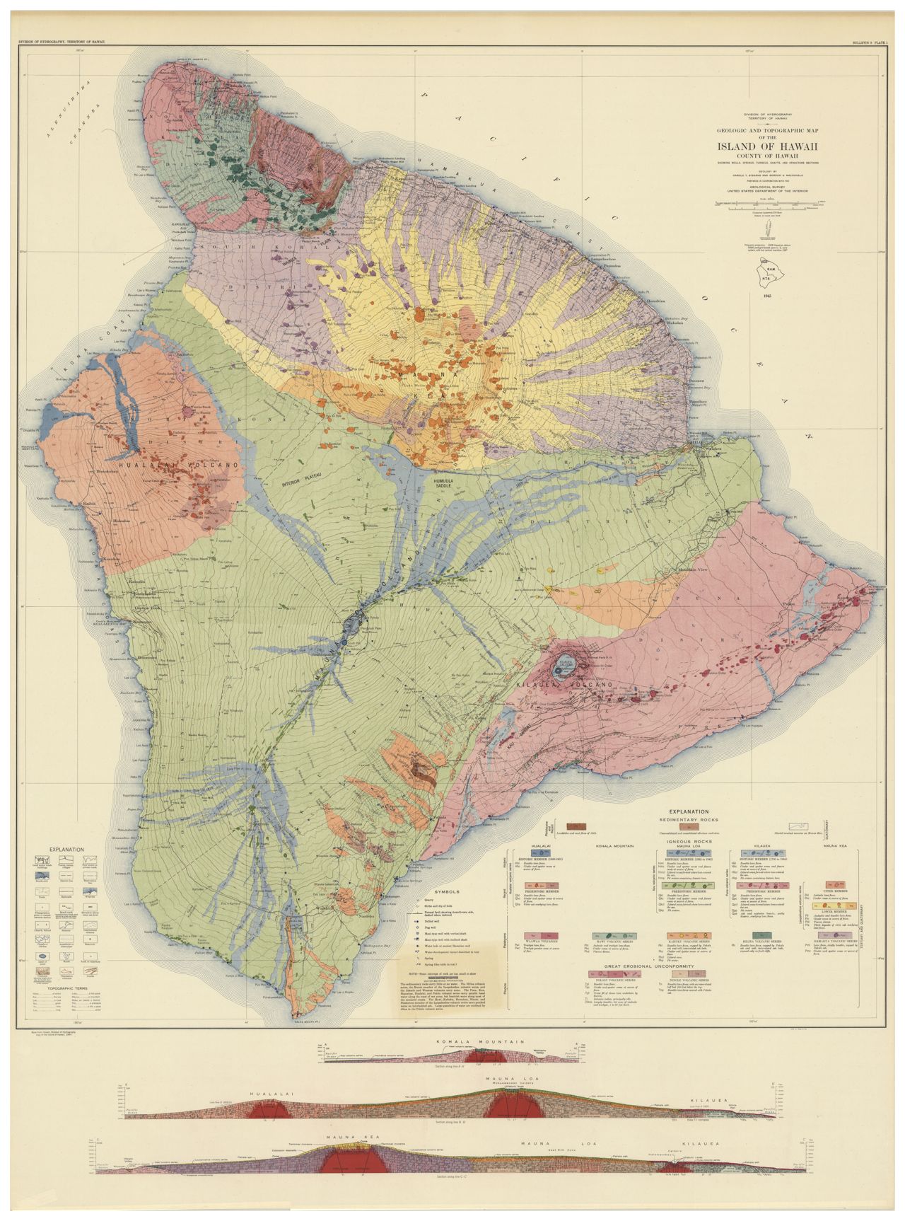
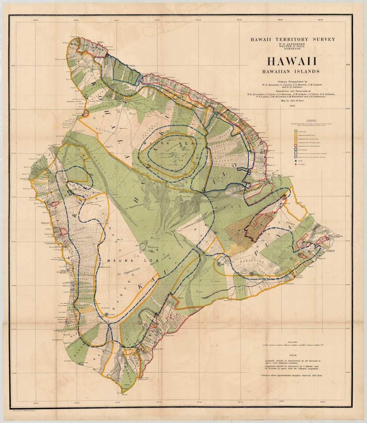
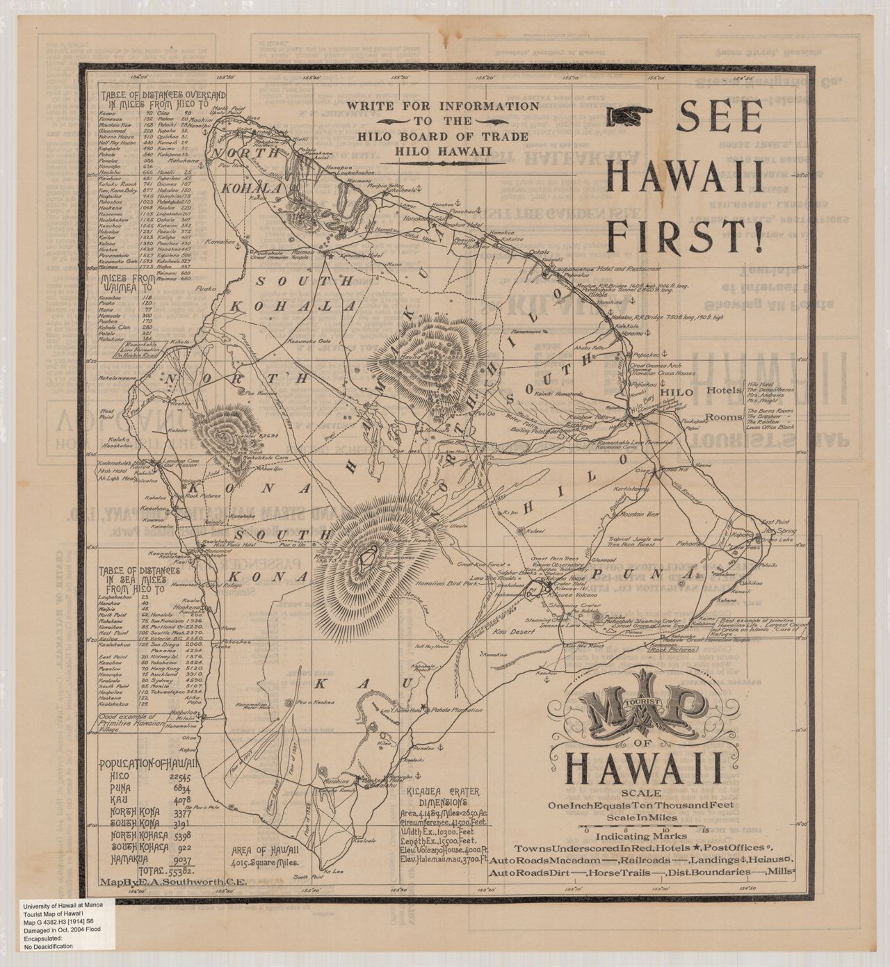
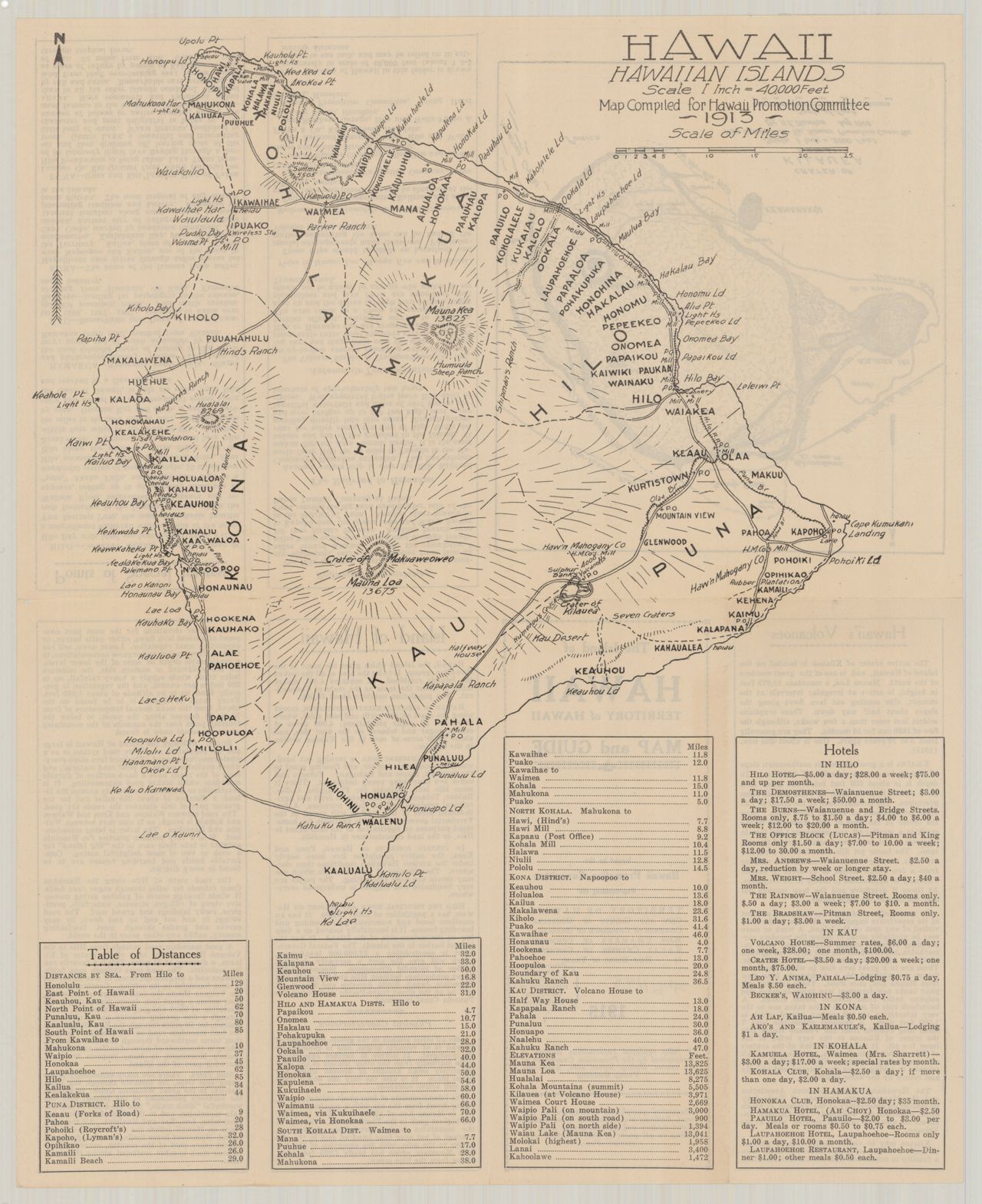
 2006 Hawai'i the big island (Global Graphics)
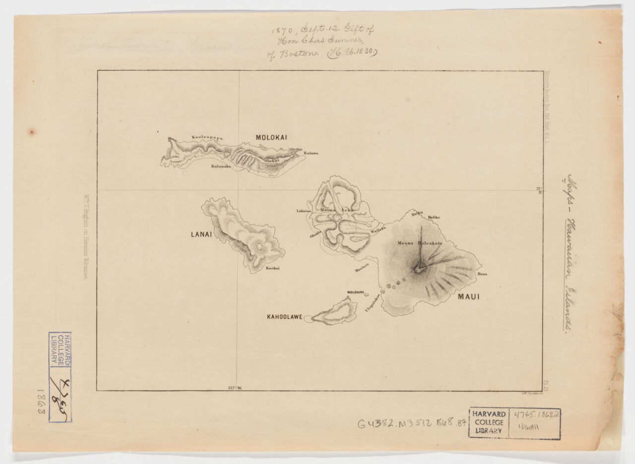 1868 Kahoolawe, Wm. T. Brigham on Hawaiian volcanoes
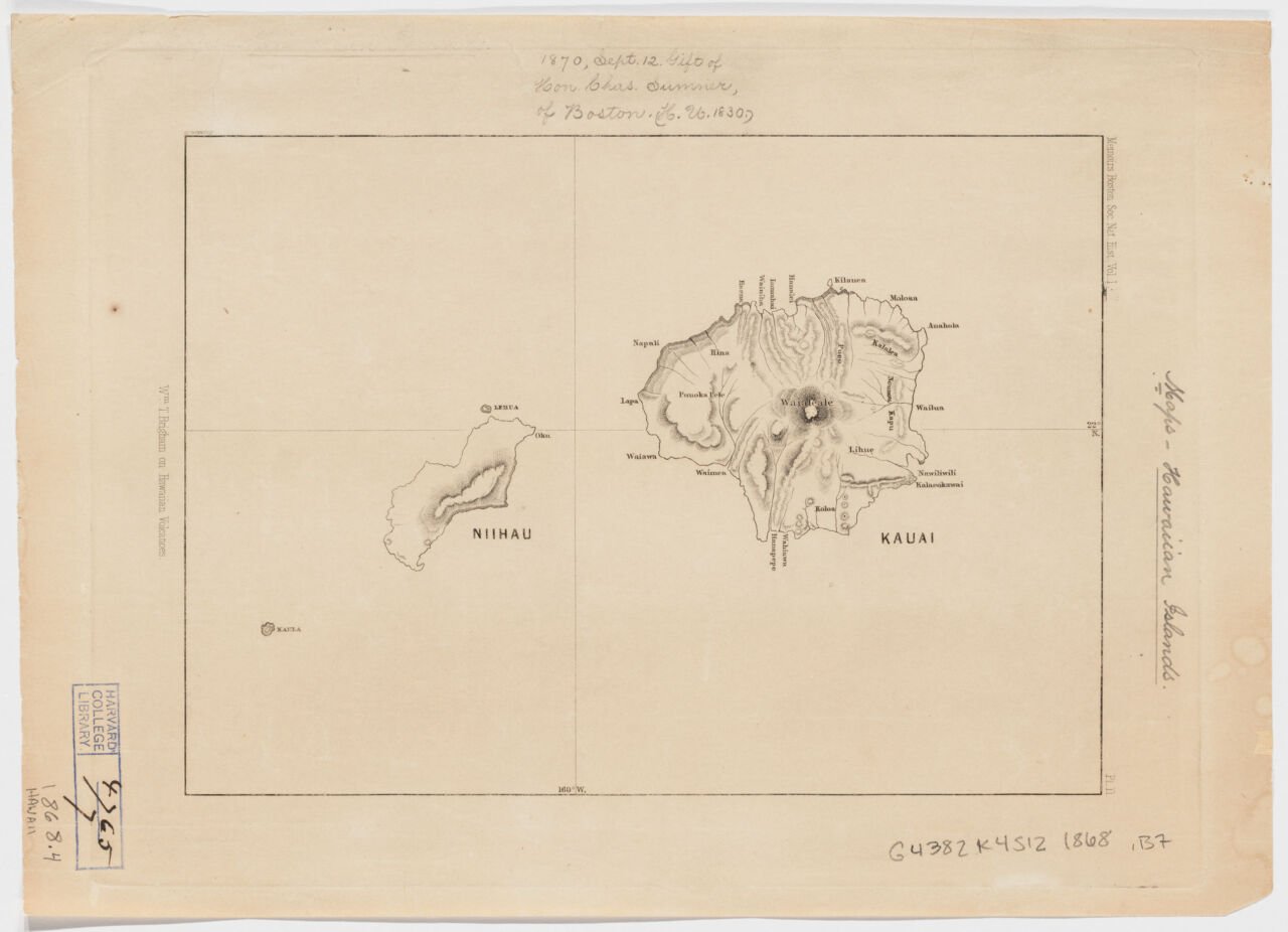 1868 Kauai, Wm. T. Brigham on Hawaiian volcanoes
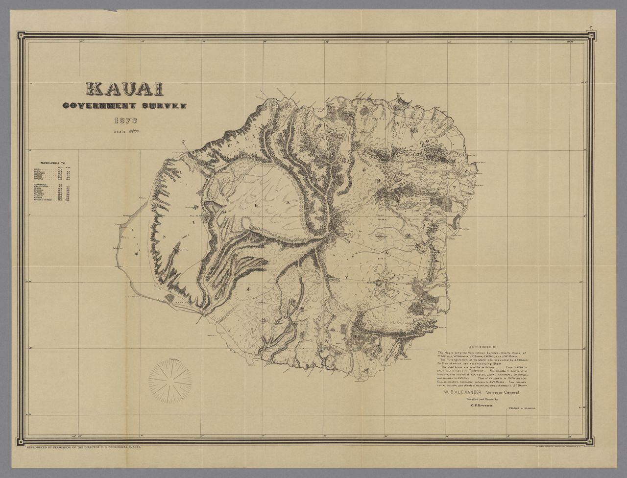
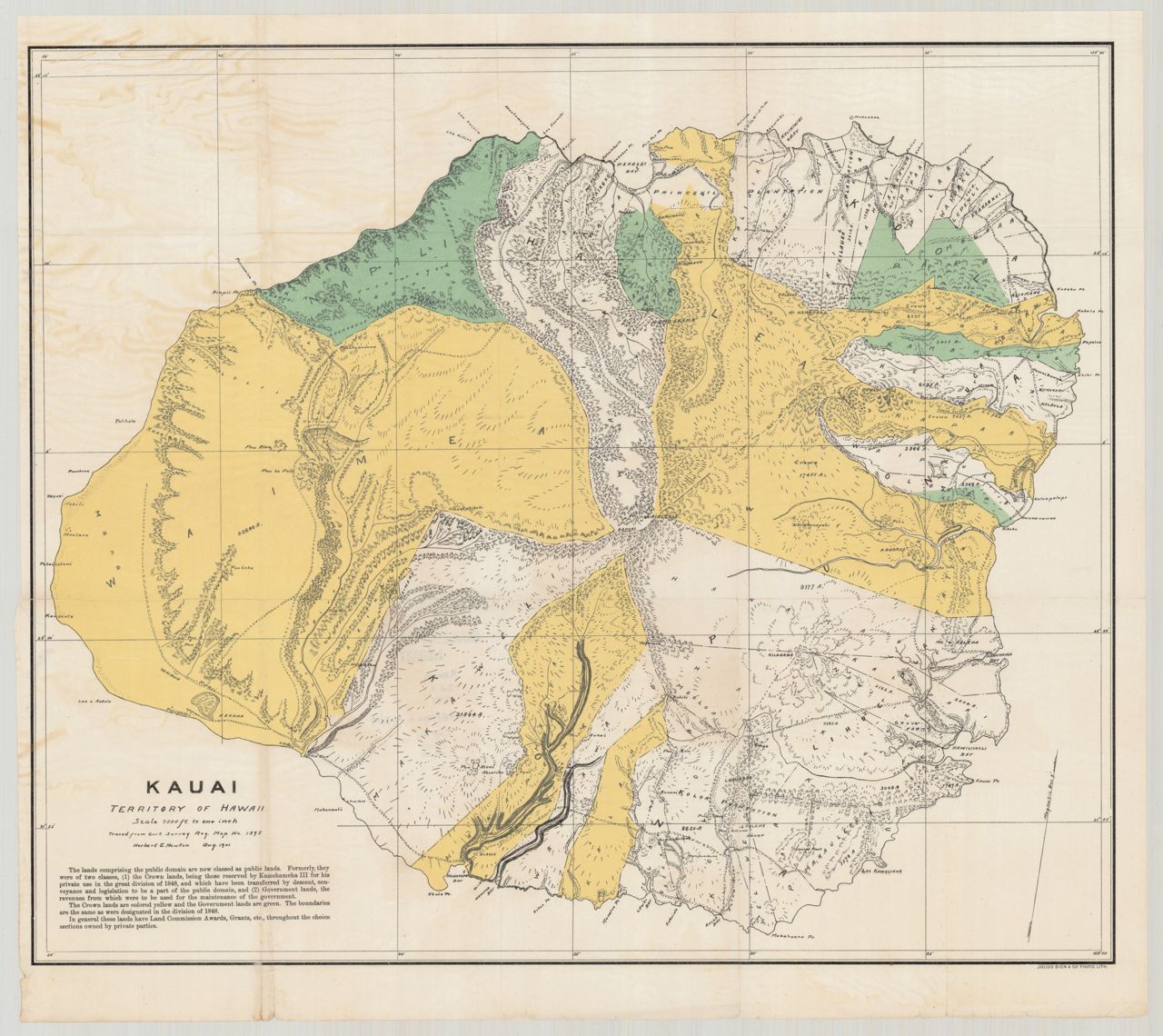
 1903 Kauai (Donn)
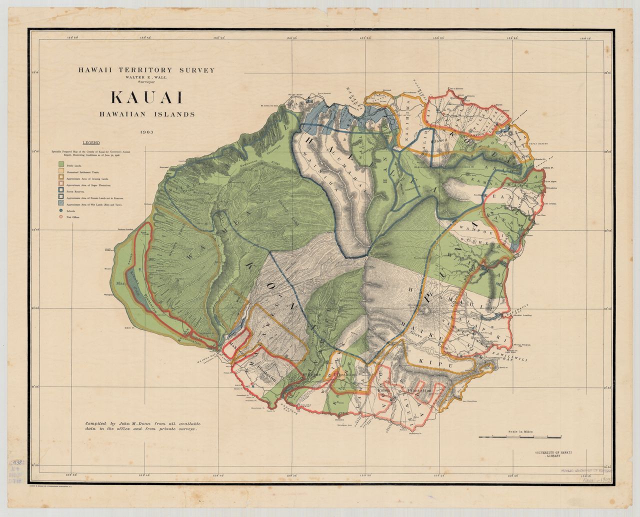
 1906 Kauai (Donn)
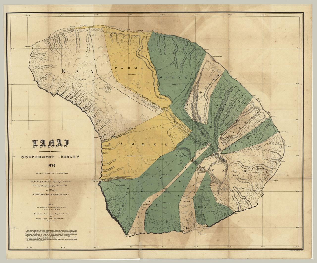
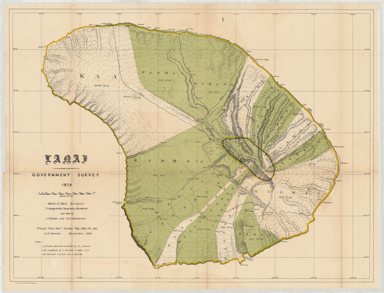
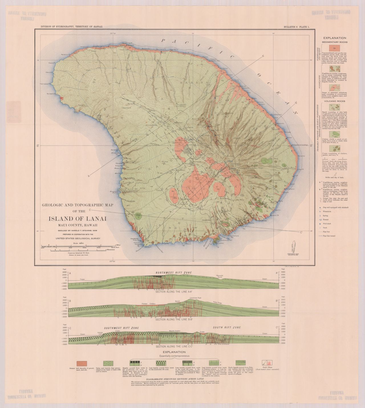
 1912 Kauai (topographic)1868 Lanai, Wm. T. Brigham on Hawaiian volcanoes1868 Maui, Wm. T. Brigham on Hawaiian volcanoes
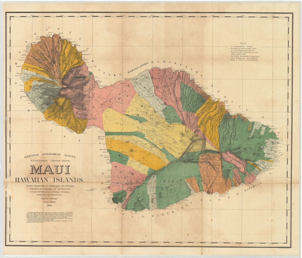
 1885 Maui (Alexander), proof version?
 1885 Maui (Alexander)
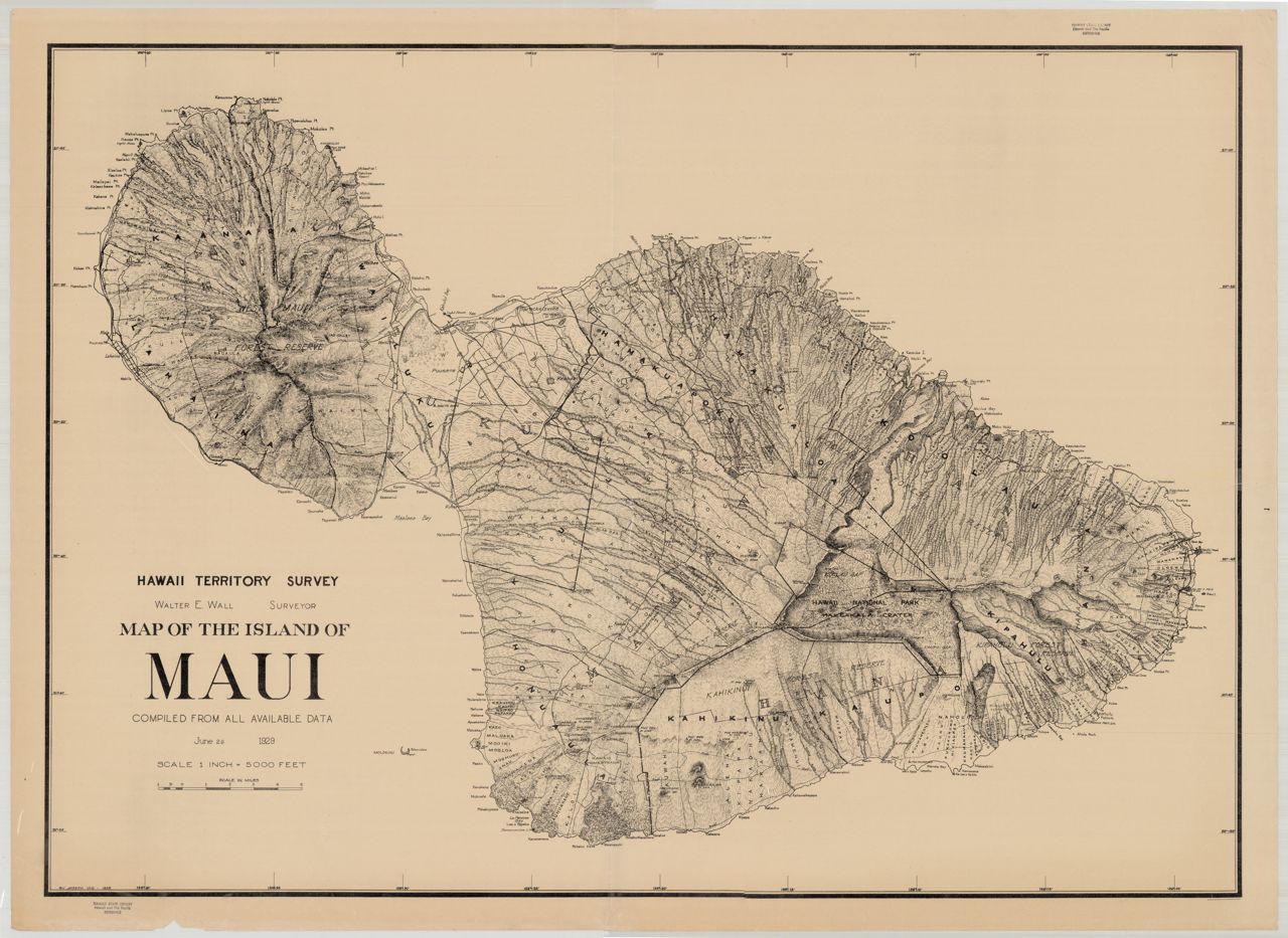
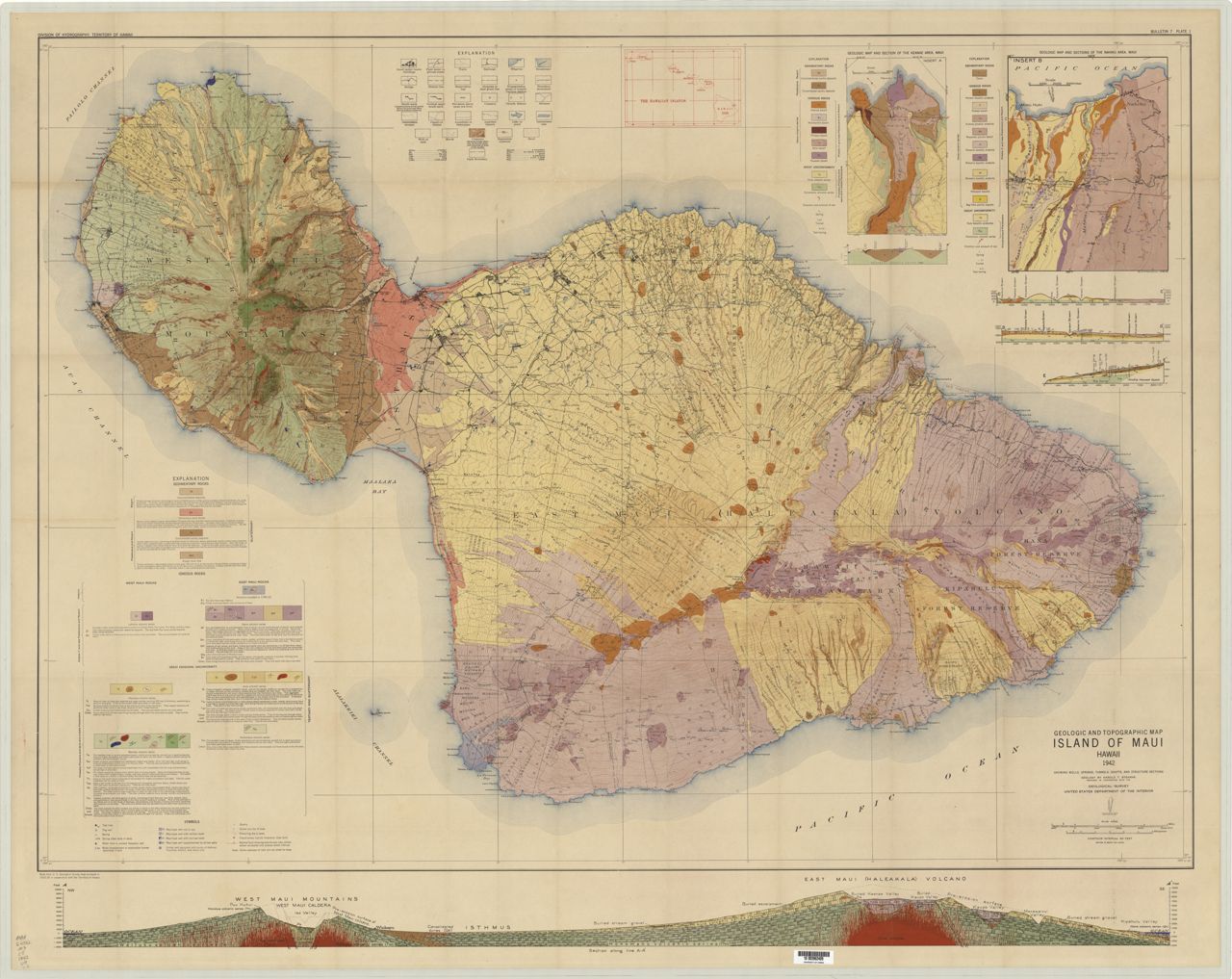
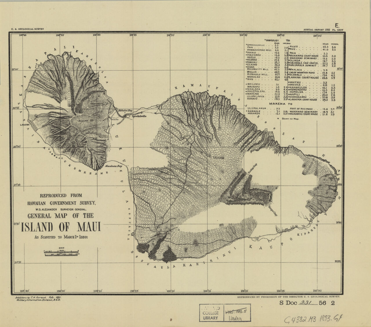 1893 General map of the island of Maui
 1903 Maui (Alexander)1868 Molokai, Wm. T. Brigham on Hawaiian volcanoes
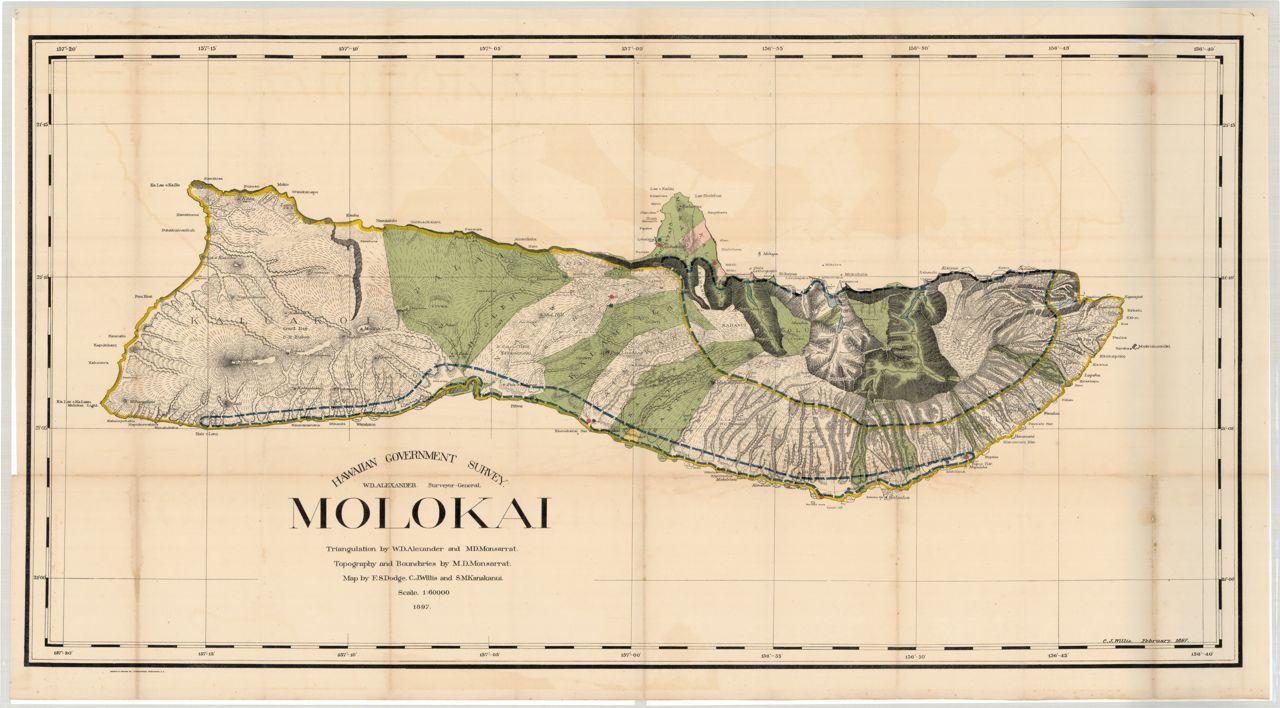
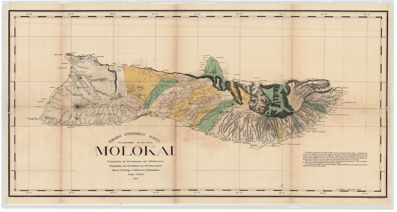
 1904 Map of Molokai. Map Showing Location of Fish Ponds on Molokai
 1906 Molokai (Alexander)
 1924 Molokai (topographic)1868 Niihau, Wm. T. Brigham on Hawaiian volcanoes
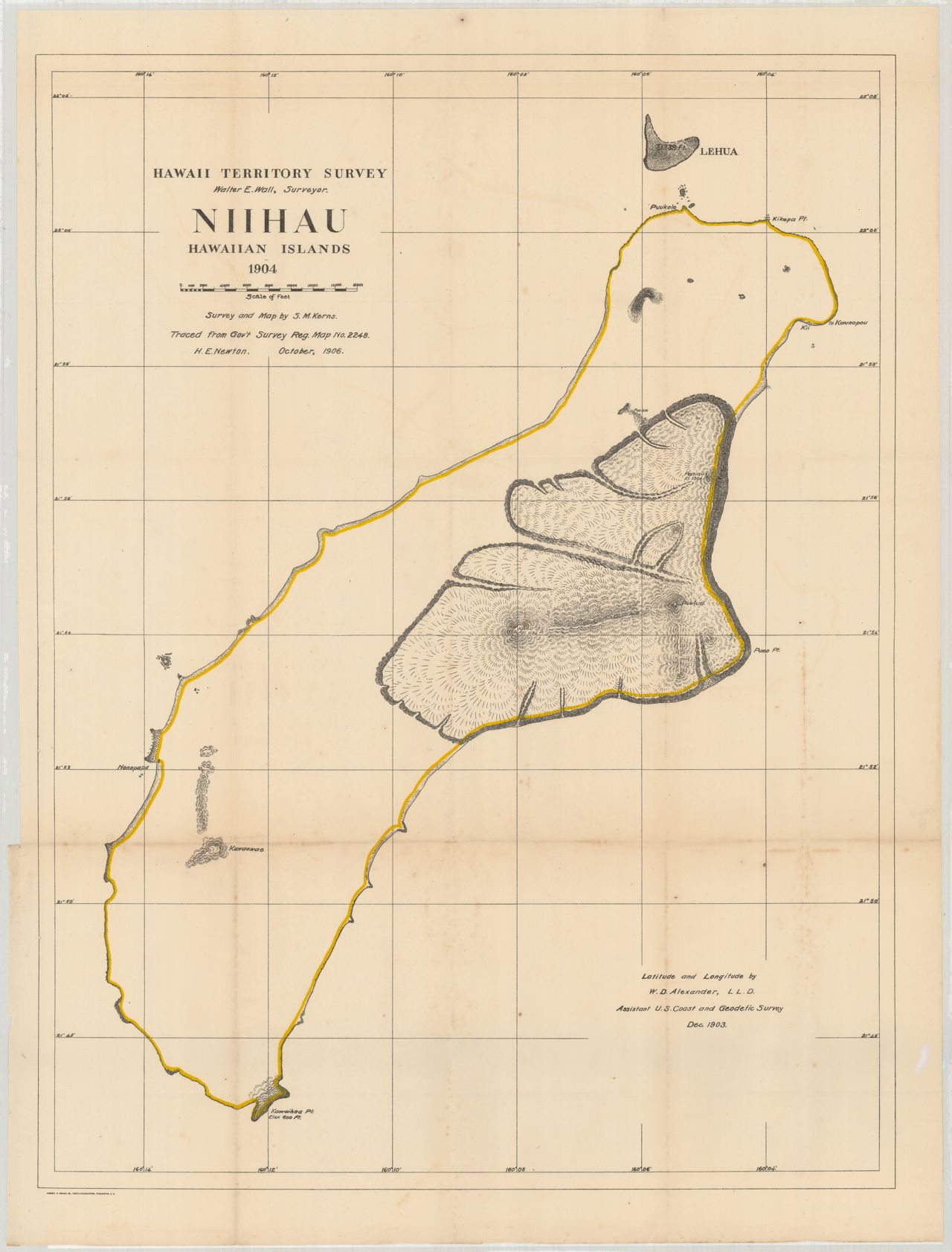
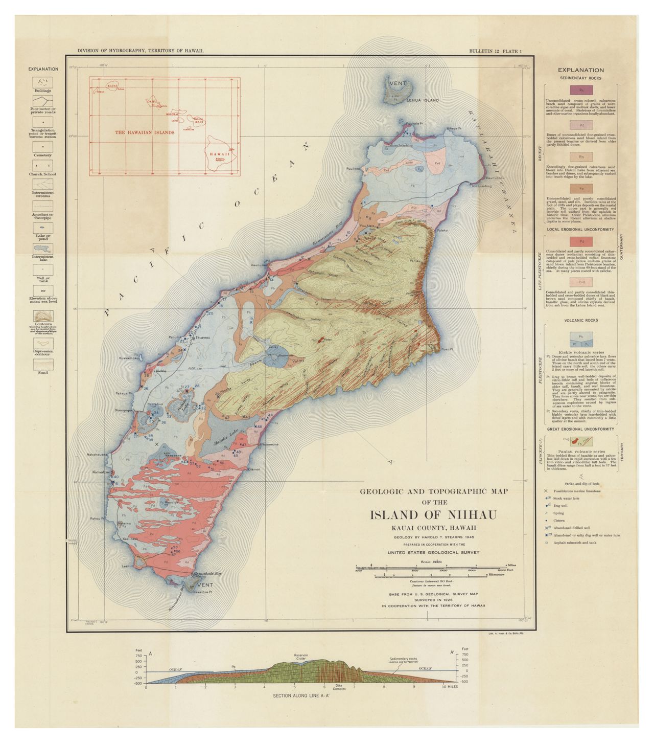
 1929 Topographic map of the Island of Niihau
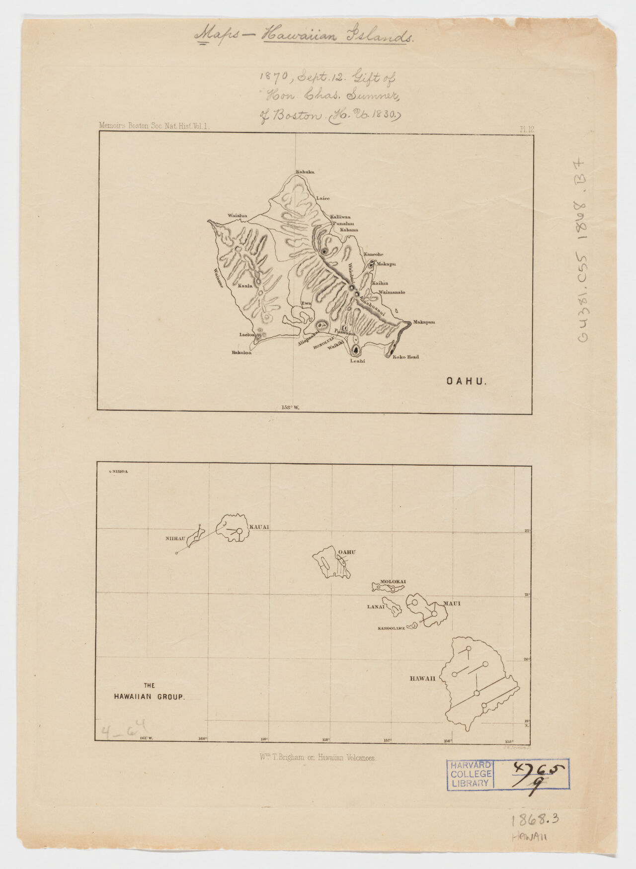 1868 Oahu, Wm. T. Brigham on Hawaiian volcanoes
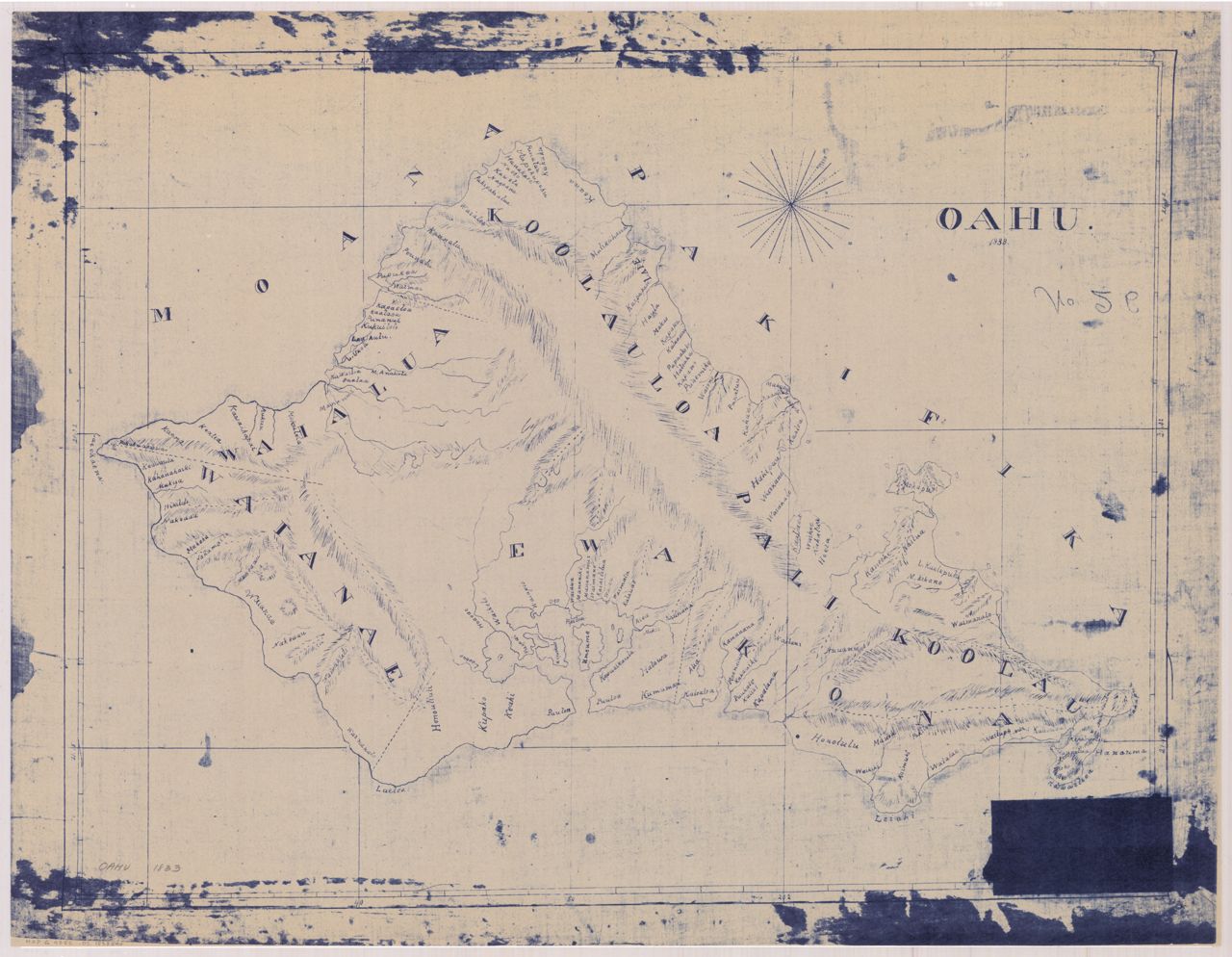
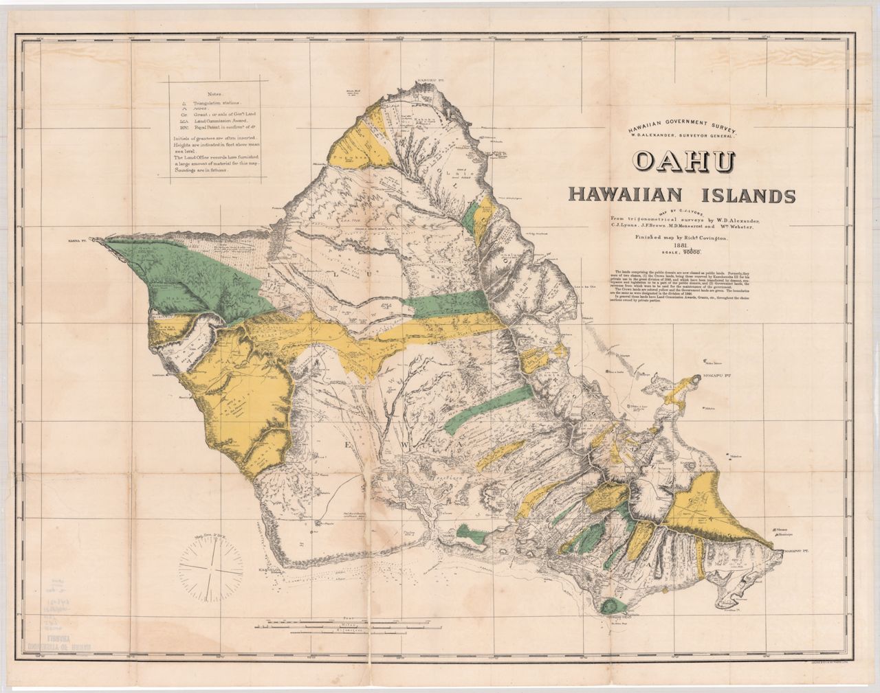
 1881 Oahu (Lyons, 1:60,000)
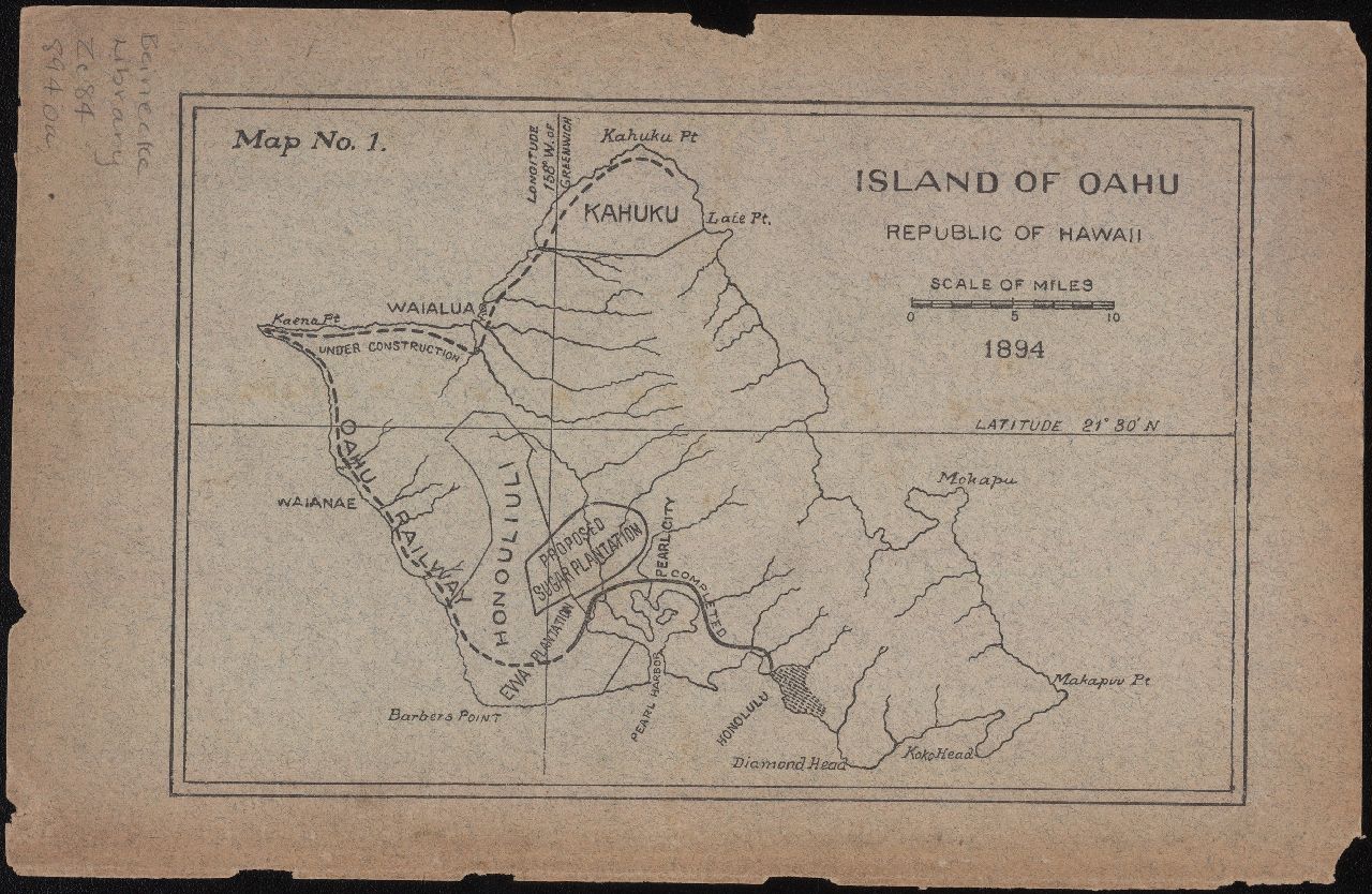 1894 Island of Oahu, Republic of Hawaii
 1899 Oahu (Beasley)
 1902 Oahu (Donn, bitonal, two pieces, left)
 1902 Oahu (Donn, bitonal, two pieces, right)
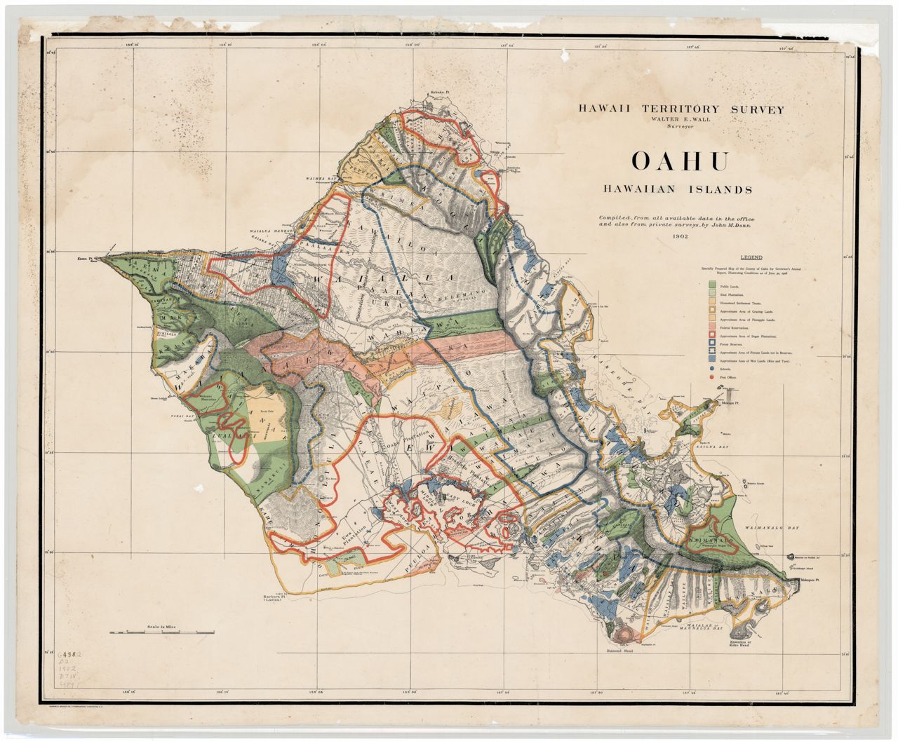
 1902 Oahu (Donn, color)
 1902 Oahu (Donn, bitonal)
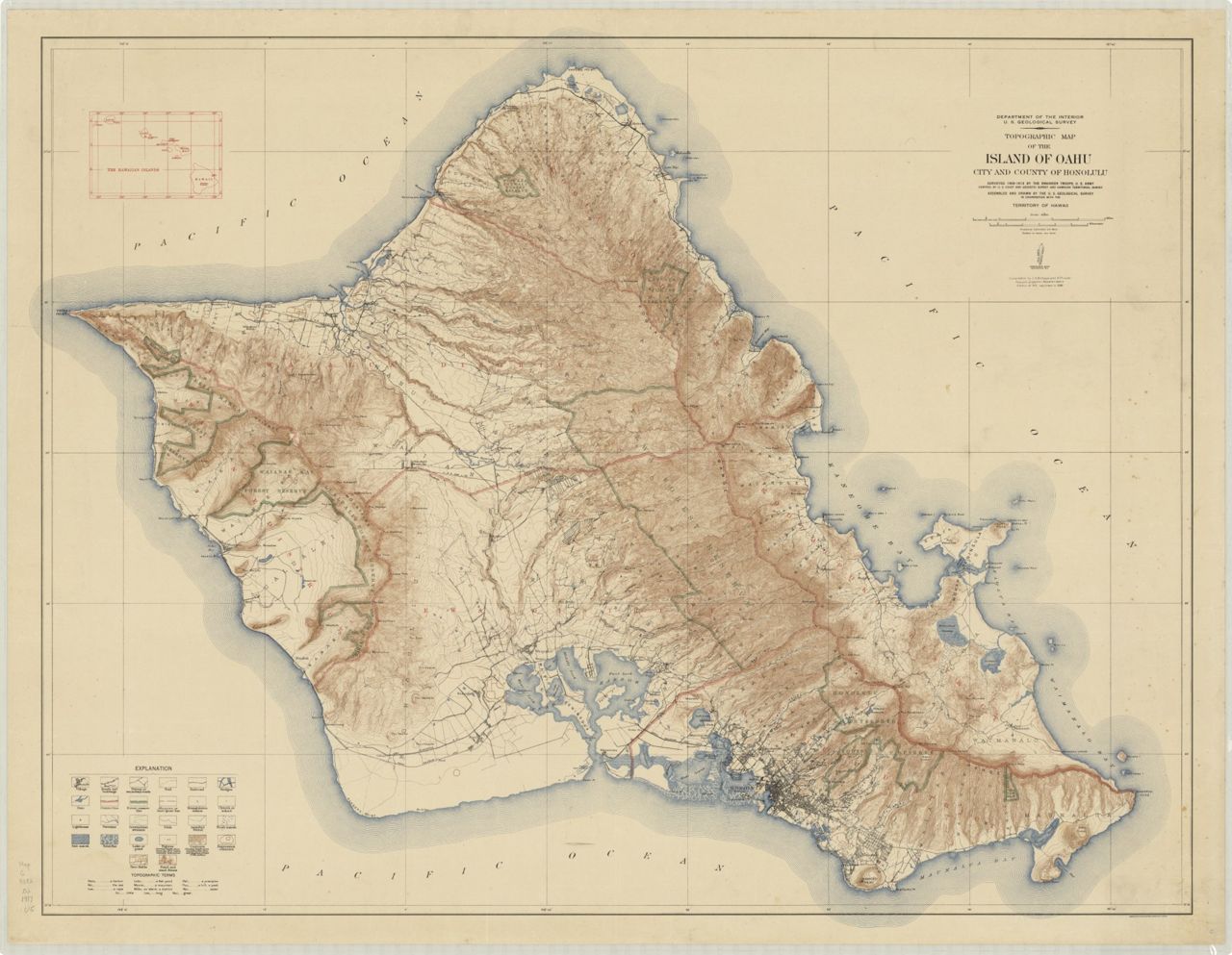
 1917 Oahu (topographic)
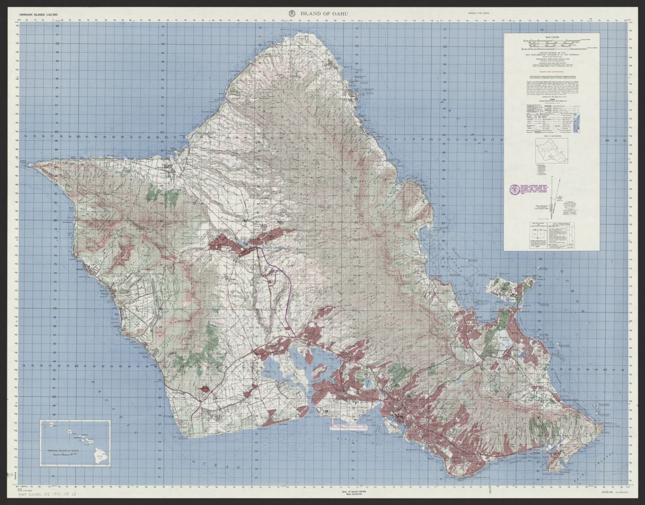
 1920 Oahu (Coast and Geodetic Survey)
 1941 December Attack Route Map of Oahu, Hawaii
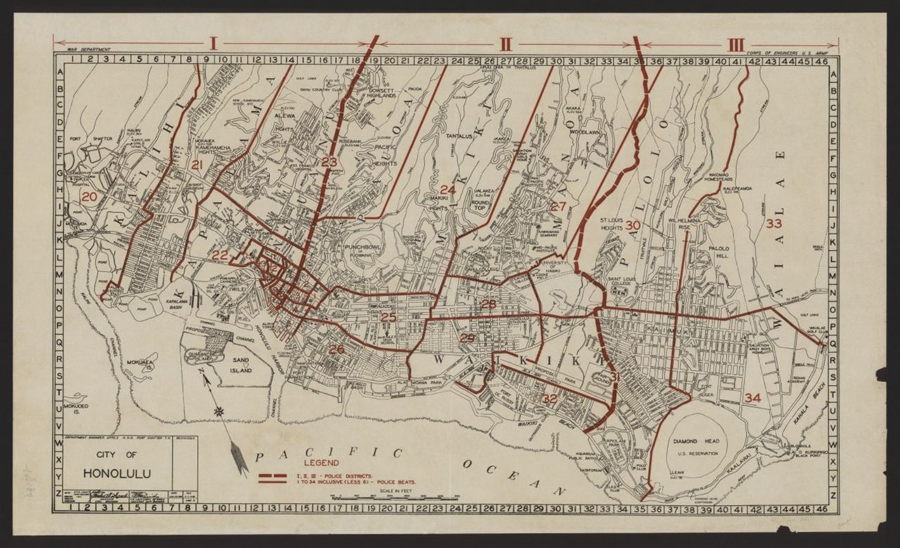
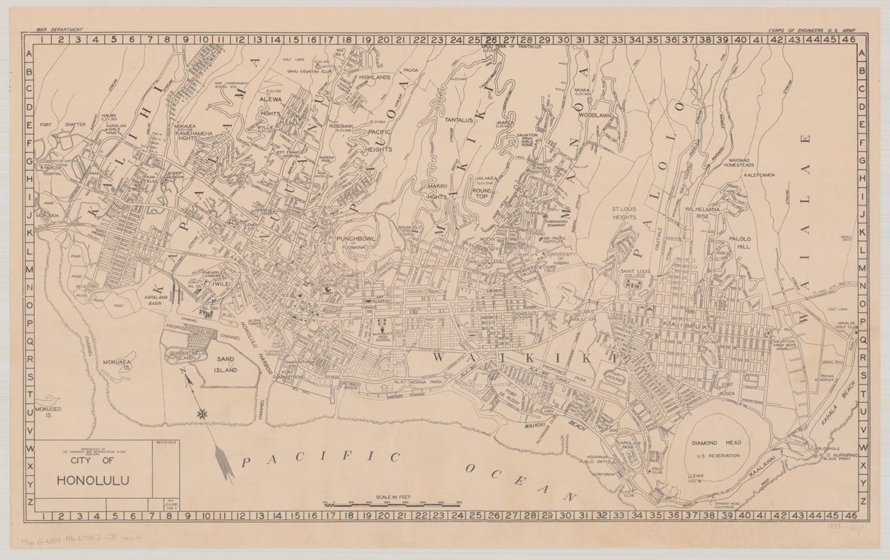
 We have different versions of these important historical maps which show building and street information for towns and cities at a large scale. The Hawaiʻi State Archives may have some maps that we do not. Consult the Union List of Sanborn & Other Fire Insurance Maps, Hawaiʻi (by Riley Moffat, revised by Philip Hoehn) for an inventory and indications where various Hawaiʻi sets may be held. The Library of Congress has one of the largest collections of Sanborn Maps with detailed explanation of the history and use of the maps. Several other sources provide useful information for reading and interpreting Sanborn maps:
Many of the Hawaii sets have been digitized and are available below:
Use the indexes below to access Hawaii topographic sets. Most sets were produced by the U.S. Geological Survey, while others were produced by the U.S. Army and the Land Study Bureau (Hawaii). The scales range from 1:20,000 to 1:50,000.
 2021 Geologic Map of the State of Hawaiʻi
 2007 Geologic Map of the State of Hawai‘i
 Disaster Alert - Global Hazards Atlas
 Map Viewers for National Centers for Environmental Information
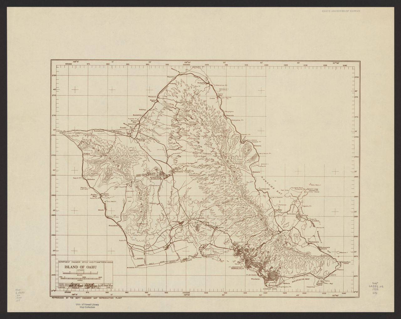
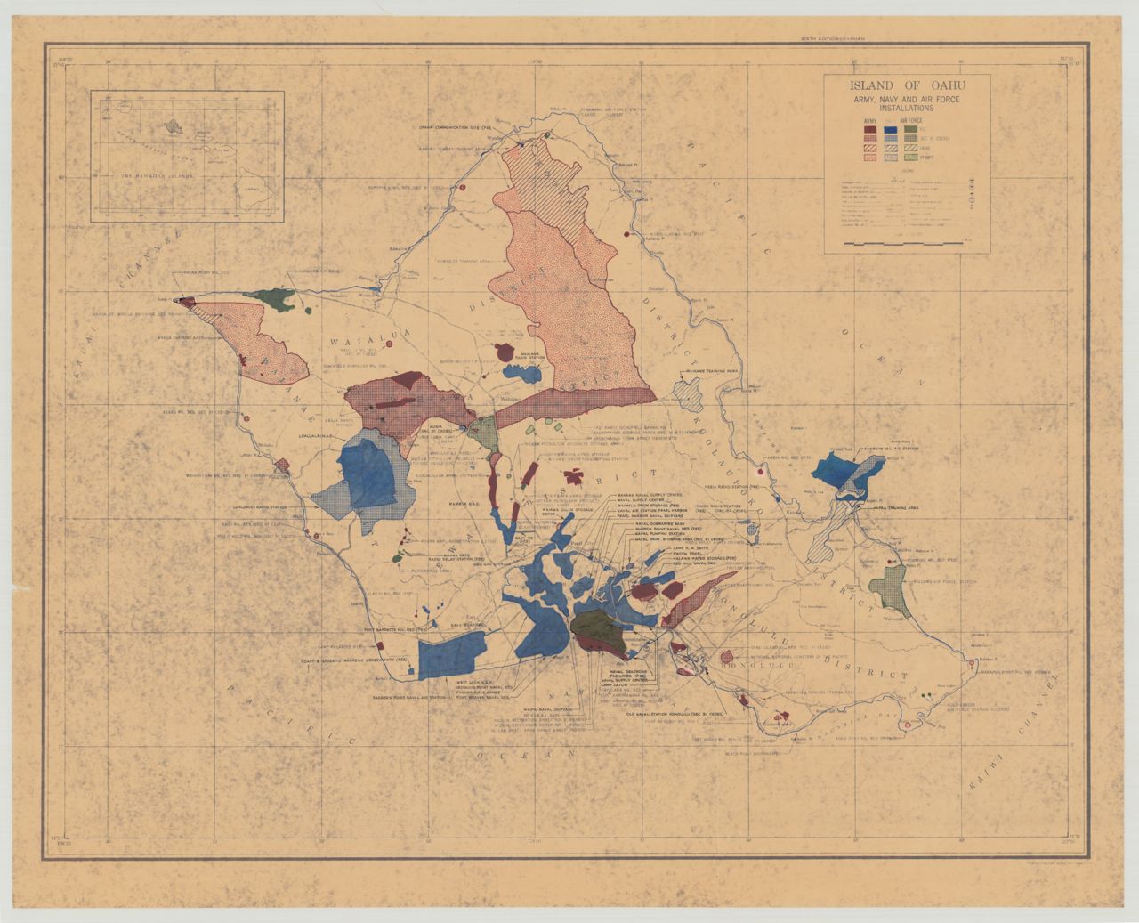
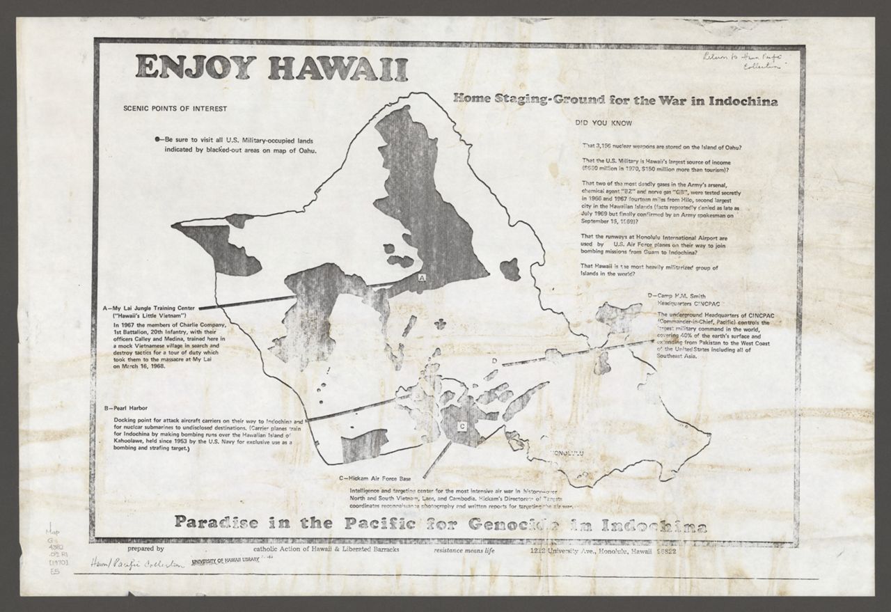
 ca. 2010 Military Occupied Areas in Hawaii
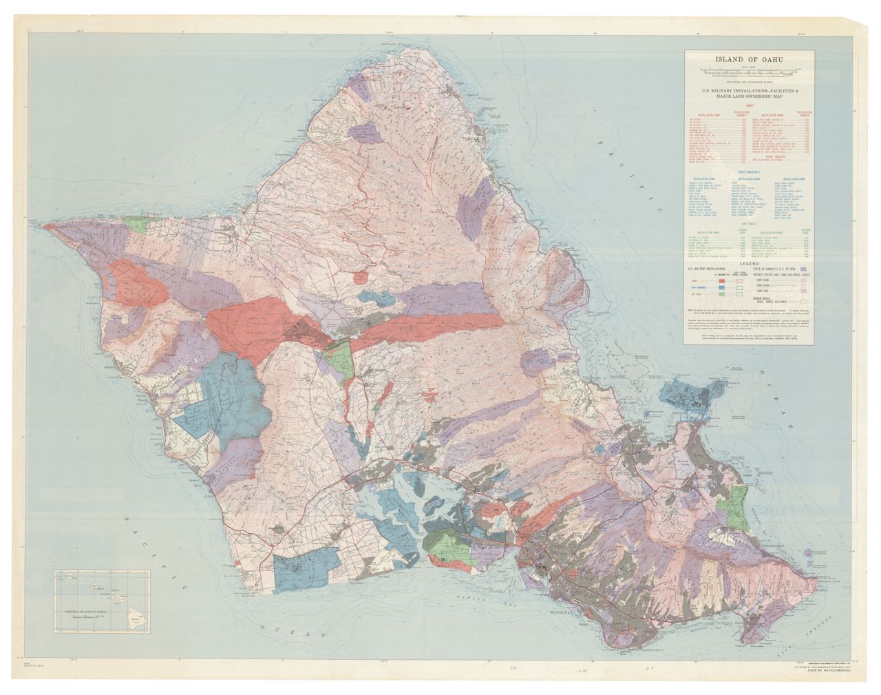
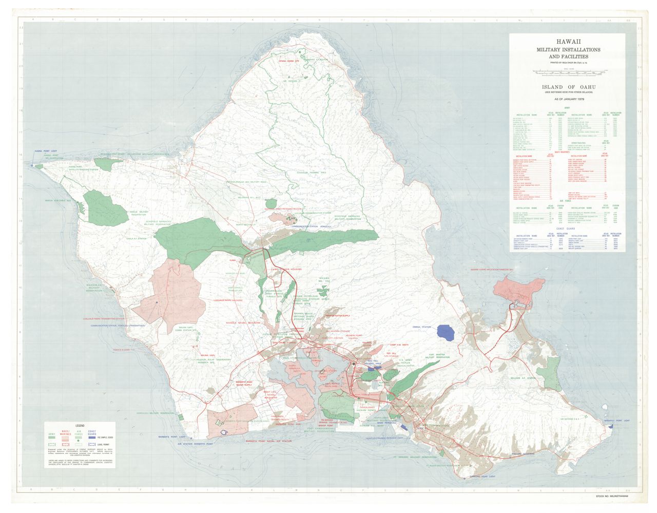
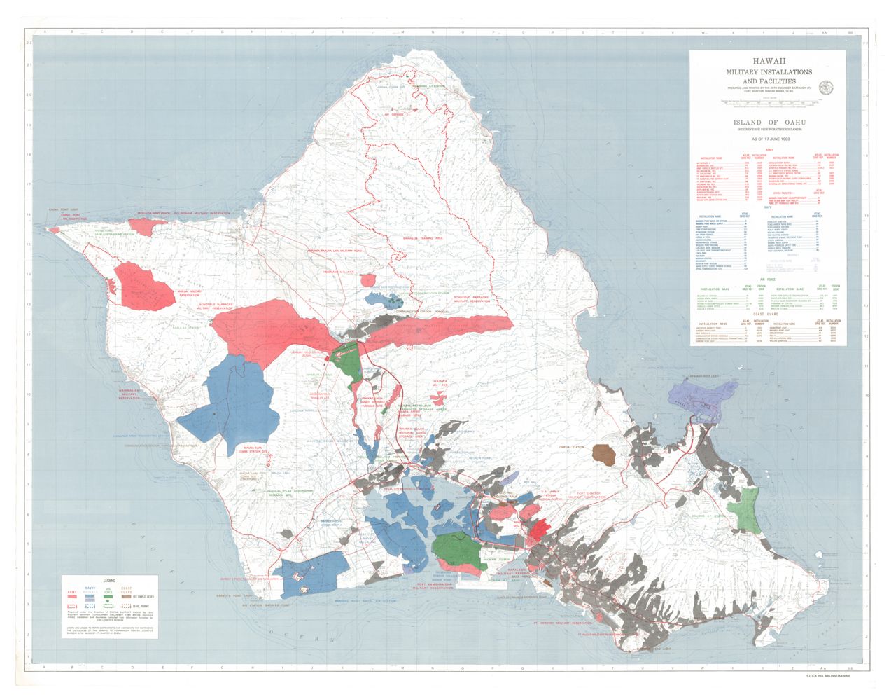


![1841 South coast of Woahoo [Oahu] and Honorurou [Honolulu] Harbour (Malden)](https://cdm17272.contentdm.oclc.org/iiif/2/agdm:3506/full/1280,/0/default.jpg)


![1907 Map of Honolulu, Hawaiian Islands [narrow] (Dove)](https://stacks.stanford.edu/image/iiif/wh116fy7106/41242hc/full/1280,/0/default.jpg)


![1992 Kaneohe Bay Master Plan [maps]](https://evols.library.manoa.hawaii.edu/iiif-server/iiif/2/9c1ba7ad-72de-42b8-868b-da985abd86ae/full/1280,/0/default.jpg)


![1850 New Chart of the Pacific Ocean [with Sandwich Islands, Honolulu, Kealakakua Bay insets]](https://stacks.stanford.edu/image/iiif/hm171rp3855/41685/full/1280,/0/default.jpg)


![1928 Hawaii (Iao) [color]](https://evols.library.manoa.hawaii.edu/iiif-server/iiif/2/c970a4d7-0895-47cc-b592-a75f60891c8f/full/1280,/0/default.jpg)